

Spanning the Hida Mountains between Toyama and Nagano Prefectures, the Tateyama Kurobe Alpine Route (立山黒部アルペンルート) features some of central Japan’s best natural vistas. Never mind that the route itself is anything but natural, with its tightly coordinated network of trains, buses, funiculars, and aerial lifts. But without all that infrastructure, one would probably require serious outdoor skills – not to mention days or weeks of travel time – to reach this rugged part of the country from the lowlands. Now, it can all be done in a day, without serious risk to life and limb.
In this pair of Field Reports, we’ll go on a journey across the full length of the scenic corridor, starting from Toyama in the west and ending at Nagano in the east.
Note: This report is based on my own experience of travelling across the Tateyama Kurobe Alpine Route on 01 October 2019. Fares, timetables, operating dates/hours and other details may change anytime without prior notice.
Click here to read my previous report covering the first three stages of the Alpine Route, done a couple of days earlier on a round trip to Midagahara (rather than on a complete crossing as described here).
Let’s have a look at the route. Small point: “Ōgizawa” is the official reading of the last station’s name (扇沢), rather than “Ōgisawa” as labelled below. (It’s a quibble, to be sure, and I still give the map’s creator high marks for preparing this excellent visual overview.)

Part 1 covers the first four legs, from Toyama all the way to Daikanbō. Part 2 (in a separate post) will focus on the remaining segments, from Daikanbō to Ōgizawa and beyond.
Now before anything else, let’s have a bit of Q&A to help set the stage.
Why didn’t you stay overnight? Staying at least one night on the Alpine Route (perhaps at Midagahara or Murodō) is highly recommended. More relaxed pace, more time for longer hikes and excursions. Alas, vacancies were thin on the ground for my dates of travel, and the remaining rooms were prohibitively expensive. This brings me to the next question…
Why Toyama as a base? Toyama (富山) is the closest major city to the Alpine Route’s western end, offering easy access via the Toyama Chihō Railway. It’s also a stop on the Hokuriku Shinkansen line, which supplies convenient high-speed services to Kanazawa in the west and Nagano/Tōkyō in the east. Finally, it’s got something of interest to the budget-conscious traveller: a downtown area with several moderately-priced hotels to choose from.
Is it possible to cross the entire Alpine Route at any time during the year? Unfortunately, no. These mountains receive an incredible amount of snowfall during the winter, which renders much of the area inaccessible until spring. The exact dates of operation may vary each year depending on weather conditions and other factors, but here’s the schedule for 2019 to give you an idea:
– Closed for the winter until 9th April 2019.
– Partially open (Toyama-Midagahara segment) from 10th-14th April 2019.
– Fully open from 15th April to 30th November 2019.
– Closed for the winter from 1st December 2019.
Where can I find more information about the Tateyama Kurobe Alpine Route? The best starting point is the official Tateyama Kurobe Alpine Route website, which is packed with information on what to see and how to get there (including detailed timetables for all modes of transport along the way). The Alpine Route entry on Japan Guide offers a useful summary of the route’s attractions and transportation options. Between them, these two websites should have almost everything you need to plan a trip to, and across, the Alpine Route.
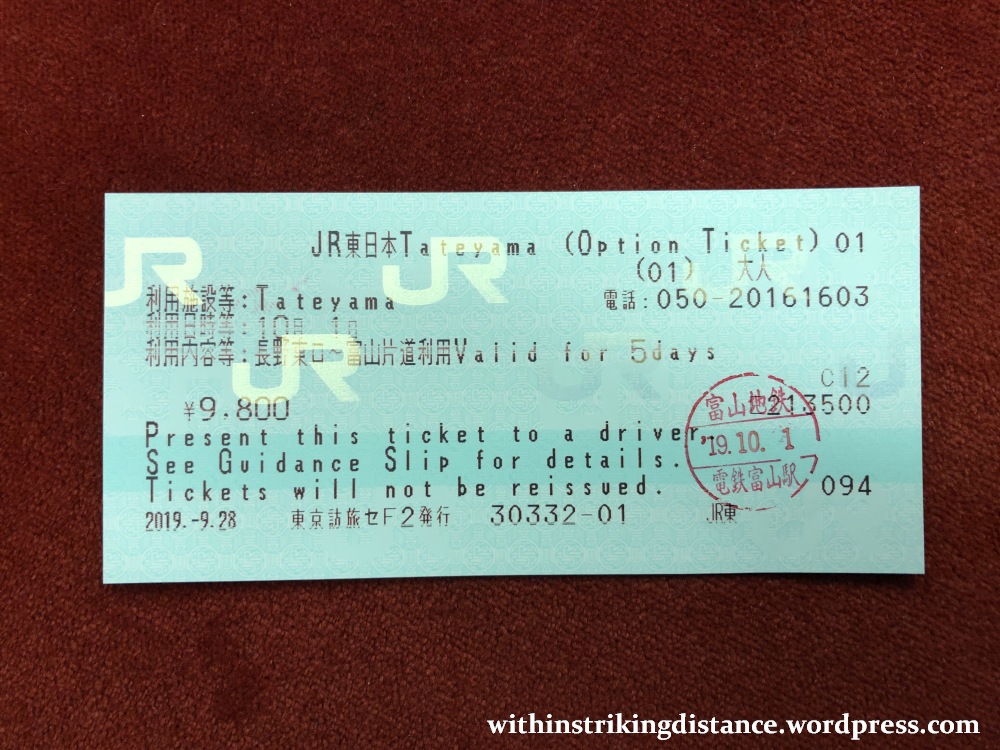
Should I purchase a Tateyama Kurobe Option Ticket? The Tateyama Kurobe Option Ticket is aimed at foreign visitors who plan to make a full Alpine Route crossing. For 9,800 yen, it gives you access to 12,460 yen worth of travel along the entire route between Dentetsu-Toyama and Nagano Stations. Buying the ticket certainly makes sense if you intend to do a complete traverse, as it will save you nearly 3,000 yen – but you’ll need to be aware of its limitations and restrictions before you make the investment.
To start: the ticket is NOT an unlimited pass, as it’s only valid for one-way travel along the Alpine Route. You can start from Toyama and end at Nagano OR the other way round, but you can’t turn back at any point without paying extra fares. Also bear in mind that the ticket is available only for a limited time each year, synchronised with the period during which the entire Alpine Route is open; check the official website for date announcements. (The sales period for 2019 ended on 10th November.) There are other things to consider – the places where you can make the purchase, the fact that it must be bought at least a day in advance, etc. – so it pays to do some research ahead of taking the plunge.
Full terms and FAQs are available on the official Tateyama Kurobe Option Ticket webpage. There’s also a brief summary on Japan Guide. If you don’t intend to purchase the Option Ticket, the Alpine Route’s official website has a wealth of details on fares and how/where to buy normal tickets.
For my part, I purchased a Tateyama Kurobe Option Ticket at the JR East Travel Service Centre in Tōkyō Station, several days ahead of my planned date of use. That’s the little green card you’ll see in some of the pictures below – and in the course of this journey, I’ll demonstrate how I made use of it. Hereinafter, to keep things brief, I’ll refer to it simply as the “Option Ticket”.
One more thing before we set off. You’ll observe that the signs and lane markers in the following pictures are mostly in green. That’s part of a colour-coding scheme in place across the Alpine Route, designed to aid travellers who might be confused as to which door or queue or platform to head for (especially at transfer points). Green signs are for eastbound travel, from Toyama/Tateyama towards Ōgizawa/Nagano. Blue denotes westbound, for those heading the other way. If you’re using the Option Ticket – which is valid for a single one-way journey – it’s important to stick to the one direction (hence the one colour) all the way, lest you accidentally end up going in reverse at any point and becoming liable to pay extra charges.
FIRST STAGE OF THE CROSSING: TOYAMA TO TATEYAMA ON THE TOYAMA CHIHŌ RAILWAY
Change in elevation: From 7 to 475 metres above sea level
Scheduled departure: 0525
Scheduled arrival: 0616
My starting point was Dentetsu-Toyama Station (電鉄富山駅, Dentetsu-Toyama-eki), the quaint little neighbour of JR West’s much larger Toyama Station.
A regular train service will take you from here to Tateyama Station in 60-80 minutes and for 1,230 yen (one way). The Option Ticket covers the full fare on non-express trains. A very small number of limited express services also ply the route, taking about 50 minutes to cover the same distance – but you’ll need to pay an extra 210 yen to board one of those.
For more details, have a look through the official website of Toyama Chihō Railway.
I wanted the earliest possible start and aimed for the very first train: a 0525 service bound for Tateyama. Oddly enough, whilst operationally a special service as noted on the information board (second train from the top)…

…it seems that this train’s not classed as a “limited express” (特急), but as a “rapid” (快急), and therefore the Option Ticket can be used to board it at no additional cost. Either that or they’ve merely forgotten to charge me extra at the turnstiles, haha.
One thing they didn’t forget at the entrance…
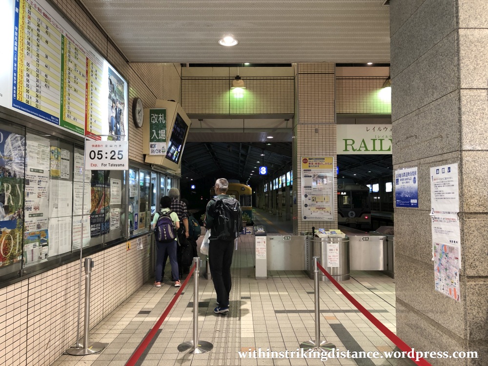
…was to apply a red station seal to my Option Ticket, which marked it as used and also triggered the five-day clock on its validity period. Of course, I wasn’t sleeping or camping out on the Alpine Route itself, so I only needed the one day.
At platform 3, I spotted a Type 10030 EMU waiting to depart as the 0514 service bound for Unazuki Onsen…

…but that’s not my ride for the day.
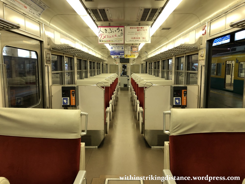
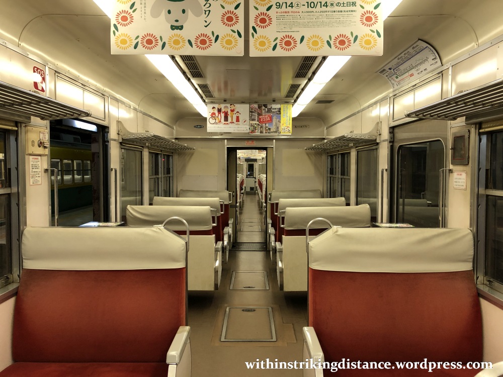
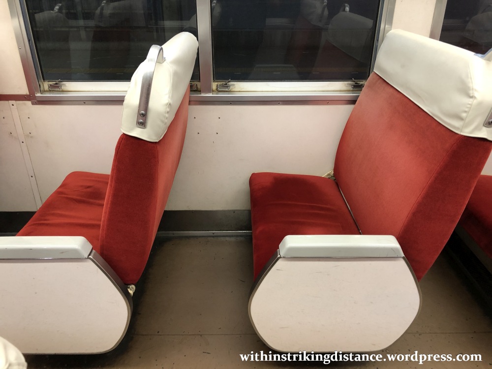
My train was the one across the island at platform 2: a Type 14760 EMU bound for Tateyama (as indicated on its signboard).

A faster train this might have been, but the interiors weren’t much different from the ordinary service I’d used a few days earlier on a day trip to Midagahara (one of the stops on the Alpine Route). Clean and well-maintained … if somewhat old.
SECOND STAGE OF THE CROSSING: TATEYAMA TO BIJODAIRA ON THE TATEYAMA CABLE CAR
Change in elevation: From 475 to 977 metres above sea level
Scheduled departure: 0700
Scheduled arrival: 0707
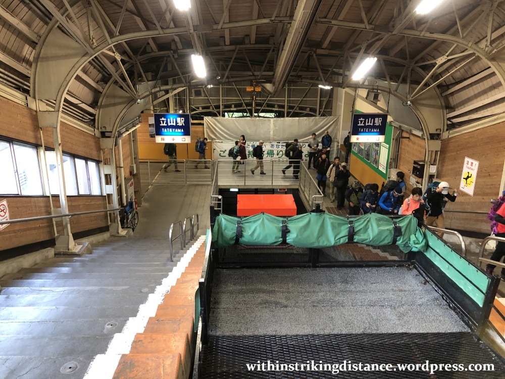
The train ride ended at Tateyama Station (立山駅, Tateyama-eki), where I transferred to the Tateyama Cable Car.
After getting off the train, I mounted the staircase located right by the turnstiles…
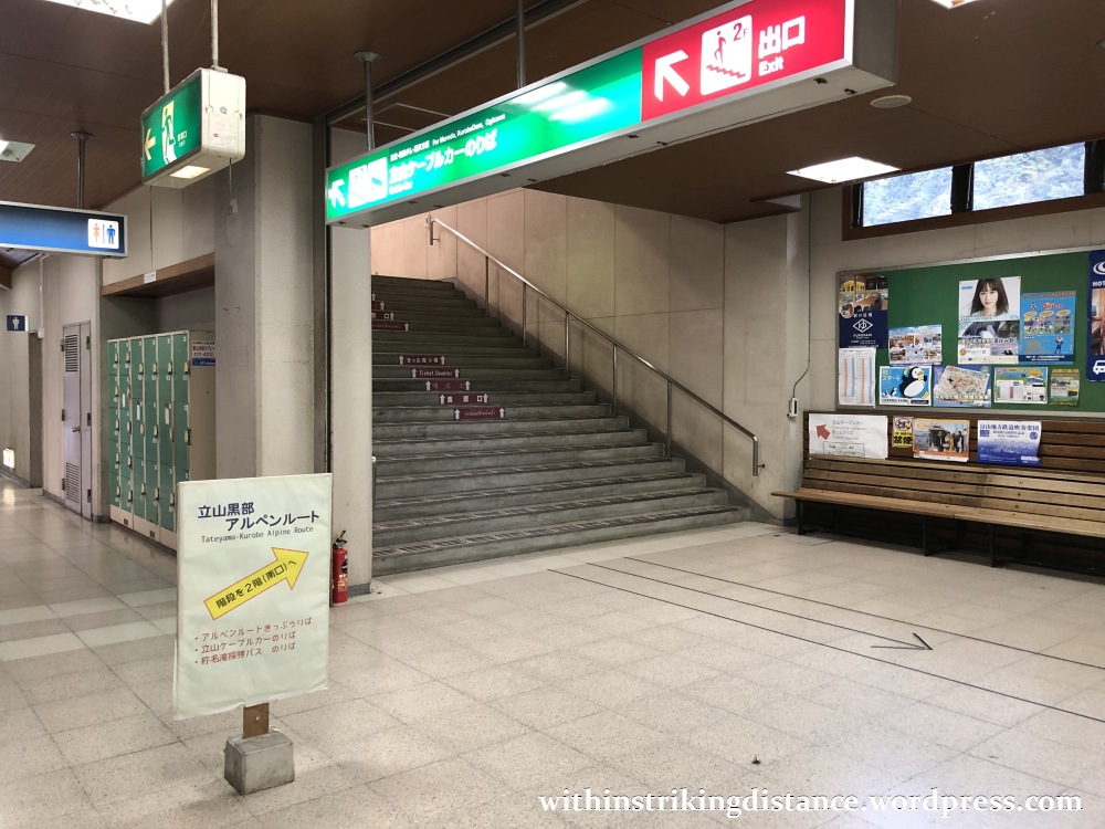
…then rushed through the station lobby and straight out the exit, turning left at the foot of the stairs towards the ticket office.

That was no mistake on my part. You can’t simply walk onto the cable car platform and board the next Bijodaira-bound service, not even if you’ve got an Option Ticket. Whether using one or paying the fare directly, you’ll need to approach the ticket office – located just outside the station’s main doors – and request a scheduled boarding card.
Note the queue, even at this relatively early hour.
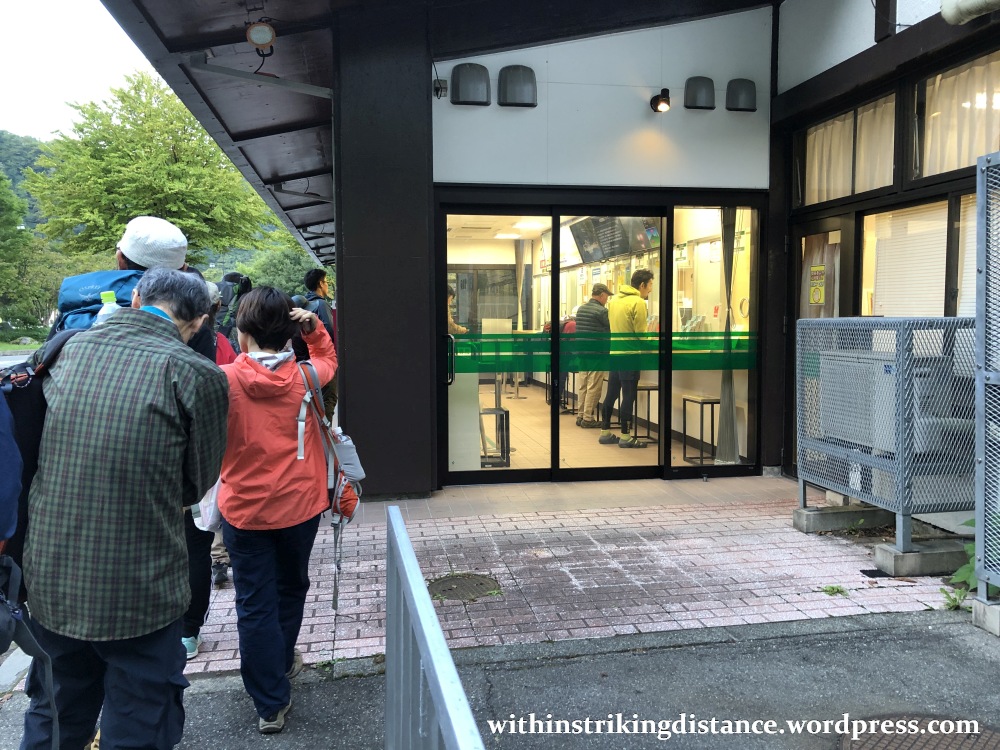
To go by their clothing and equipment, I’d say this was mainly a hiking and camping crowd. I imagine most of the normal tourist horde were still soundly asleep in their hotel beds or just beginning to stir for breakfast.
I presented my Option Ticket at the counter, where it immediately earned two more battle scars. One’s a round blue station seal, the other a rectangular black stamp.
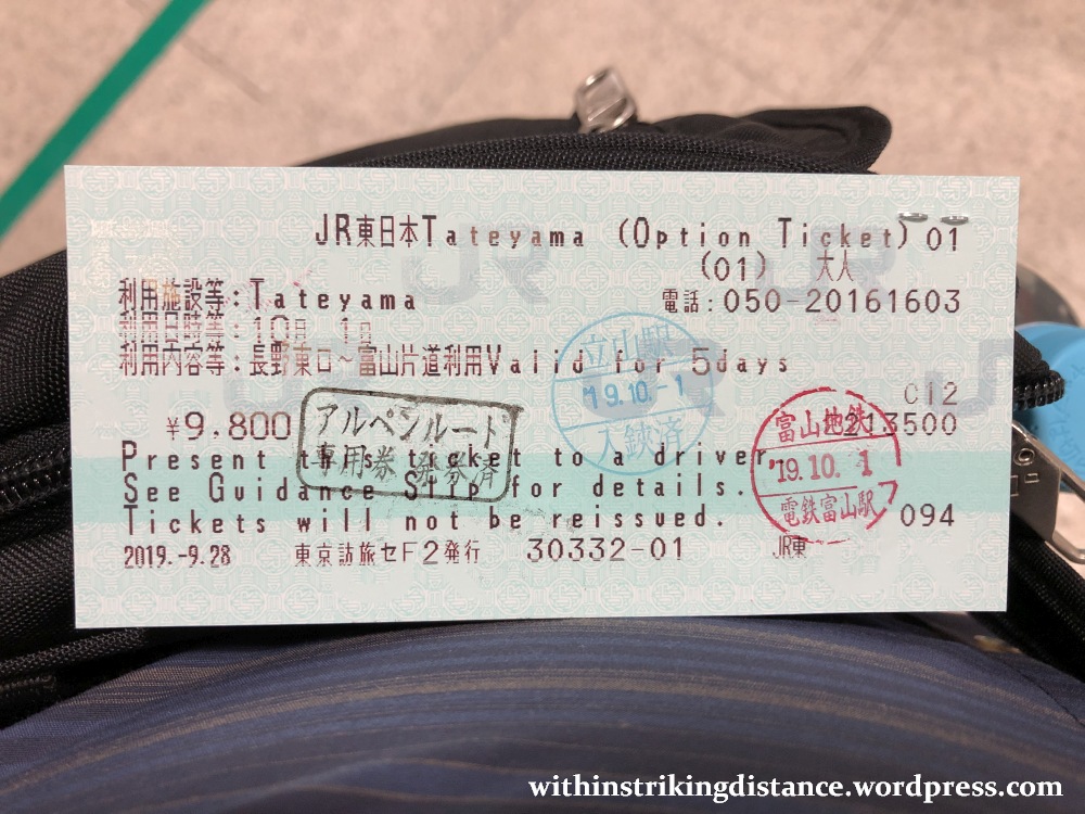
The counter staff also stapled something to the back: a barcoded boarding card covering the entire Alpine Route between here and Ōgizawa. From this station onward, it’s the barcode (rather than the Option Ticket itself) that will admit me through every turnstile and every mode of transport save for the very last bus leg to Nagano (where the Option Ticket is in play again).
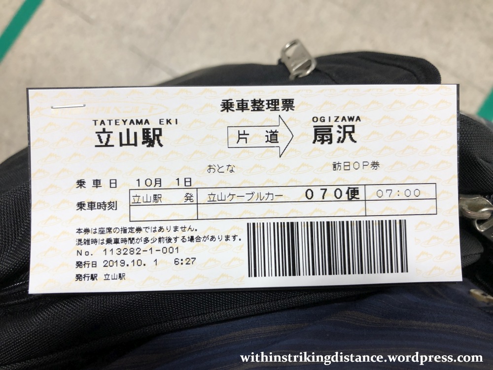
Unlike on my previous side trip to Midagahara – for which I’d purchased a ticket on the spot – no cash changed hands here. My Option Ticket covered the full fare for the boarding card I received.
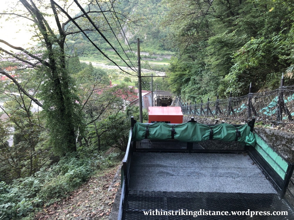
Back up to the station lobby now, where I joined the queue for my assigned schedule: the 0700 Tateyama Cable Car service to Bijodaira.
I stood at the head of the car the last time I was here. Now I was standing at the tail and looking down at our progress rather than up.


THIRD STAGE OF THE CROSSING: BIJODAIRA TO MURODŌ ON THE TATEYAMA HIGHLAND BUS
Change in elevation: From 977 to 2,450 metres above sea level
Approximate departure: 0718
Approximate arrival: 0804
The cable car deposited me at Bijodaira Station (美女平駅, Bijodaira-eki).
This is the starting point of the Tateyama Highland Bus line, which shuttles passengers as far as Murodō. Some buses travel the route non-stop, whilst others pause at Midagahara and Tengudaira along the way. There are separate queues for either service.
I joined queue #2 when I was here a couple of days earlier, since I wanted to get off at Midagahara. Today, with Murodō as my next destination, I kept to the right at #1.
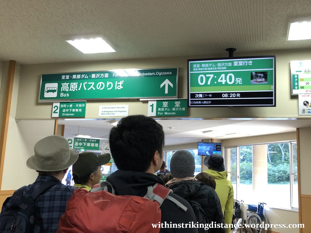
Note that I’ve indicated “approximate” times above, rather than “scheduled”. That’s because the non-stop services aren’t listed on the published timetables, and don’t even show up on the information screens. (Observe how the display indicates a 0740 departure, which happens to be the next all-stop bus.)
All passengers are guaranteed a seat – important for safety on the long, zig-zagging mountain route – but places are not specifically reserved. Just hop aboard and take any unoccupied seat.
I’ve read that fold-down seats spanning the aisle may be deployed at peak times, but in any event, standing is not allowed (again for safety reasons). Best to join the queue as early as possible, or you’ll risk being forced to wait for another bus if all seats are taken.

The first part of the ride was pretty much a repeat of what I’d experienced the last time I embarked on on the Alpine Route. If you’re planning to make a stopover at Midagahara (which in the right season is certainly worth doing), please have a look at these two previous reports: one setting out how to reach Midagahara in the first place, and the other describing what you can expect to see there.
Needless to say, things were rather different after we passed Midagahara (which was as far as I’d gotten the last time). To start, I was treated to a wider view of the Midagahara wetland – the flat expanse spreading from the centre of the image all the way to the right – once we’d reached a stretch of road overlooking the area.

My word, look at those mountains. I was denied that view during my walk around Midagahara a few days earlier, thanks – or I should I say no thanks – to some rather heavy cloud cover. Today’s conditions were far better for spending time outdoors, with clear skies and bright sunshine … as I’d soon discover after setting foot at Murodō.
But let’s leave that for another post. 😉
We kept gaining altitude from here, rising above Midagahara (which was already quite high up at 1,930 metres) as the bus sped towards Murodō. The landscape also changed considerably, with trees becoming fewer and far between. Quite wonderful to look at, especially with autumn colours already spreading across the mountains … although a moving bus with a fair bit of window glare wasn’t really the best place from which to snap pictures.
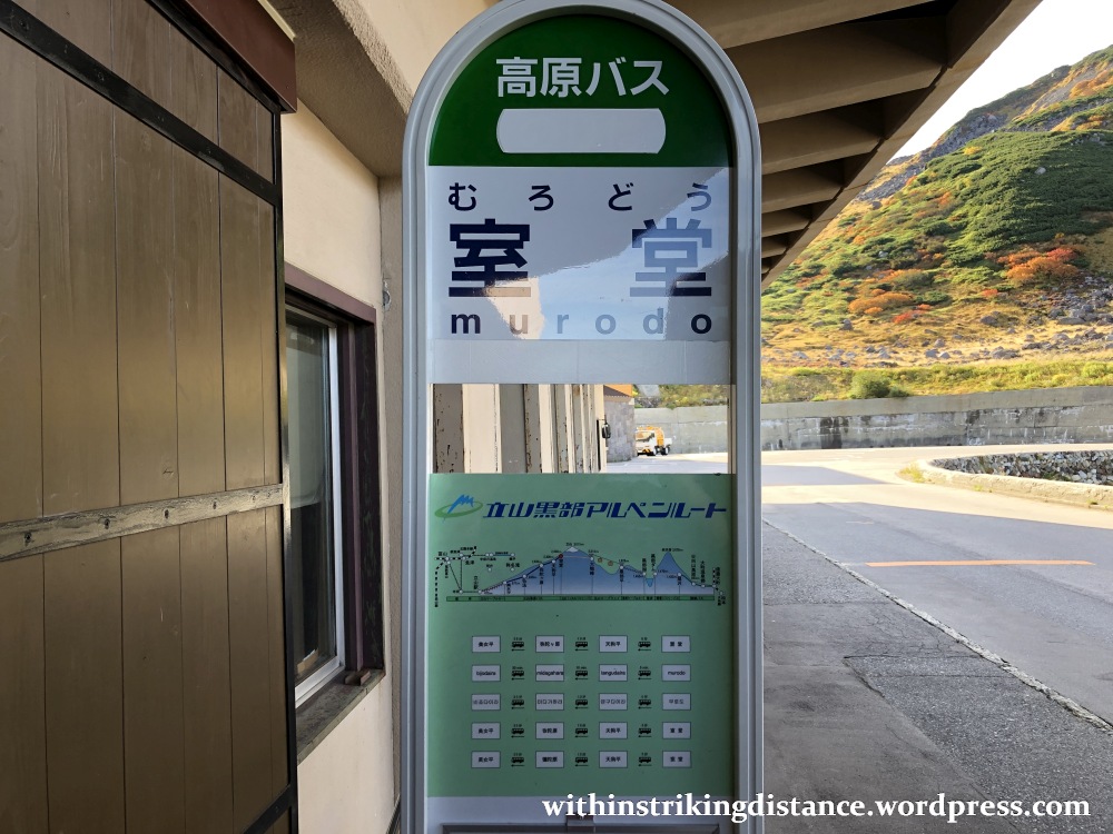
And here we are: Murodō.
This place was the absolute highlight of my Alpine Route crossing – but let’s save the details (and my rich gallery of pictures) for a separate post. Best to give that tale enough room to stretch its legs.
FOURTH STAGE OF THE CROSSING: MURODŌ TO DAIKANBŌ ON THE TATEYAMA TUNNEL TROLLEYBUS
Change in elevation: From 2,450 to 2,316 metres above sea level
Scheduled departure: 1015
Scheduled arrival: 1025
I lingered for about 2 hours at Murodō, enjoying the fantastic natural scenery and savouring the rich autumn colours.
Afterwards, it was back to Murodō Station (室堂駅, Murodō-eki)…
…through the ticket barrier, and then onward via the next mode of transport: the Tateyama Tunnel Trolleybus.
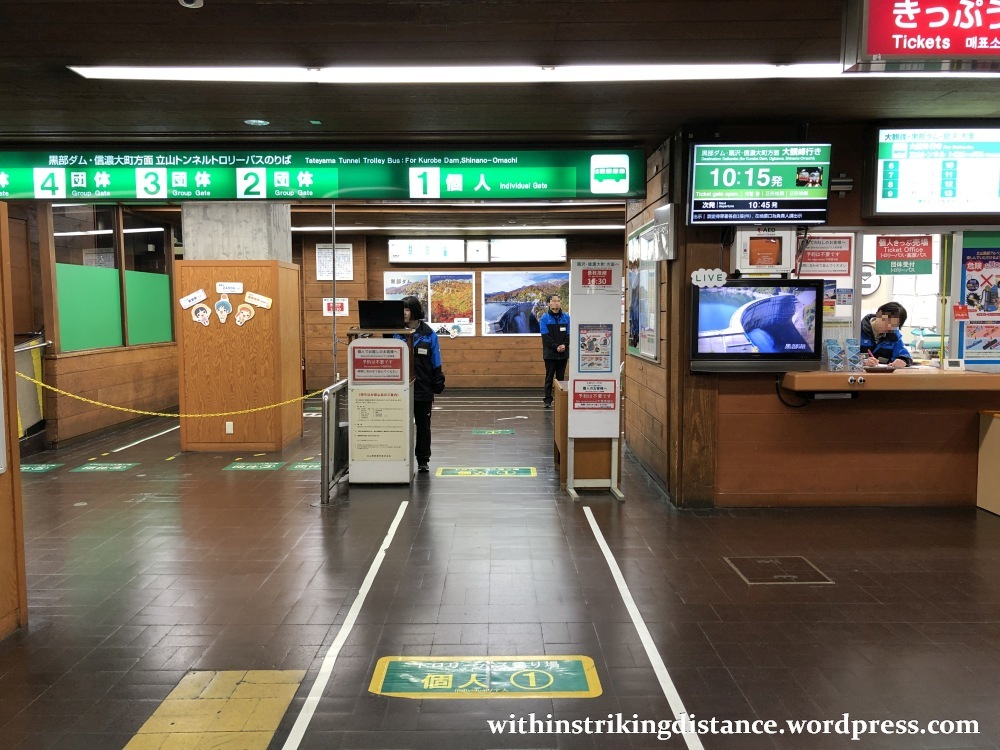
Here, my friends, is a piece of history: the last operating trolleybus line in Japan. There used to be a good number of trolleybus routes in various places across the country, but they’ve nearly all gone the way of the dinosaur, supplanted by other modes of transport such as trains or conventional buses. For a time, two lines remained in operation – and when one of them ceased running just last year, the Tateyama Tunnel Trolleybus was left as the sole remaining example of its kind.

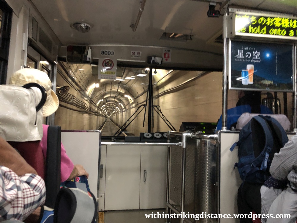
The trolleybuses themselves are very much like regular buses, except that they draw power from overhead lines (rather like trains).
And off we went, down the long tunnel that plunges straight through the heart of Tateyama: the 3,015-metre peak that overlooks the Murodō plateau.
From the station at the end of this tunnel, I began my descent in earnest – pausing on the long downward journey to admire a major feat of engineering (and one of the highlights of the Tateyama Kurobe Alpine Route)…
…but we’ll save the rest for Part 2. 🙂
Till then, cheerio.

3 thoughts on “Field Report: Tateyama Kurobe Alpine Route, Part 1 (Ascent from Toyama to Daikanbō)”