

The highest stop on the Tateyama Kurobe Alpine Route is a gateway to some of the Hida Mountains’ incredible natural beauty. Here, at 2,450 metres above sea level, even inexperienced walkers can enjoy a day in the great outdoors and surround themselves with fantastic views of the Japanese Alps.
Welcome to Murodō (室堂).
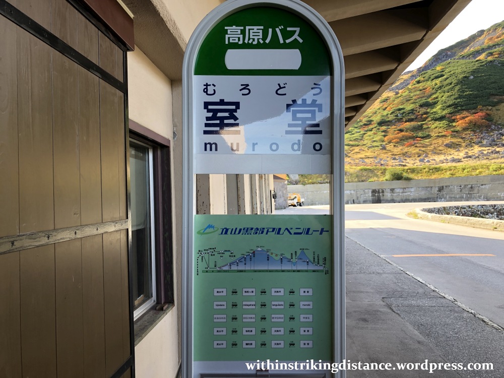
Murodō – or more specifically Murodō Station (室堂駅, Murodō-eki) – is one of several stops strung along the Tateyama Kurobe Alpine Route (立山黒部アルペンルート): a network of trains, funiculars, buses, and aerial lifts that spans the Hida Mountains between Toyama and Nagano Prefectures.
Small point: “Ōgizawa” is the official reading of the last station’s name (扇沢), rather than “Ōgisawa” as labelled below. (It’s a quibble, to be sure, and I still give the map’s creator high marks for preparing this excellent visual overview.)

Read more about my Alpine Route crossing in these related posts:
As for getting here, my report on the first few legs of the Alpine Route provides more details about the journey between Toyama (the nearest major city) and Murodō, plus one stop beyond (Daikanbō). Another report covers the stops east of Daikanbō, documenting the last segments of the Alpine Route as far as Ōgizawa and Nagano.
Right, let’s get started.
After disembarking at the Murodō terminal…
…I headed straight inside and parked myself on a vacant bench in the changing area. Murodō is a hiking hotspot, so there’s a room in the terminal building where people can transition from lowland travel clothes into heavy-duty kit.
Of course, I wasn’t going on an advanced hike so my preparations were limited. Warm top over my shirt, jacket, sun hat and so on. Oh, and liberal quantities of sunblock massaged all over my face.
That done, I mounted the steps leading up from the transport level up to the public areas, and all the way to the top.
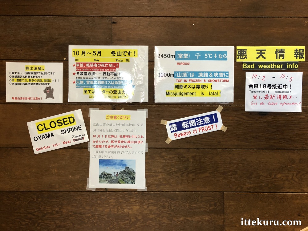
Note the warning signs posted near the stairs. The plateau itself isn’t very challenging, but the mountain trails shouldn’t be taken lightly. Pay special heed to weather warnings, such as the note seen below alerting visitors to an approaching storm.
After emerging onto the building’s large open-air deck, I took a few moments to appreciate the fine views of the surrounding area.
That’s the road my bus had travelled on to get here, leading through and past the terminal’s large parking lot. The Alpine Route’s famous “snow corridor” – featuring walls of packed snow towering above the roadway – should be visible thereabouts come next April.

Looking towards the west, through a cleft between two hills, I caught a hazy glimpse of the lowlands around Toyama from which I’d set out that morning. The massive difference in elevation between here (more than 2,400 metres) and there (closer to sea level) is quite apparent.

Very nice indeed – but it’s time to head out!
First, let’s familiarise ourselves with some of Murodō’s key landmarks using the simplified map on the Alpine Route’s official website.
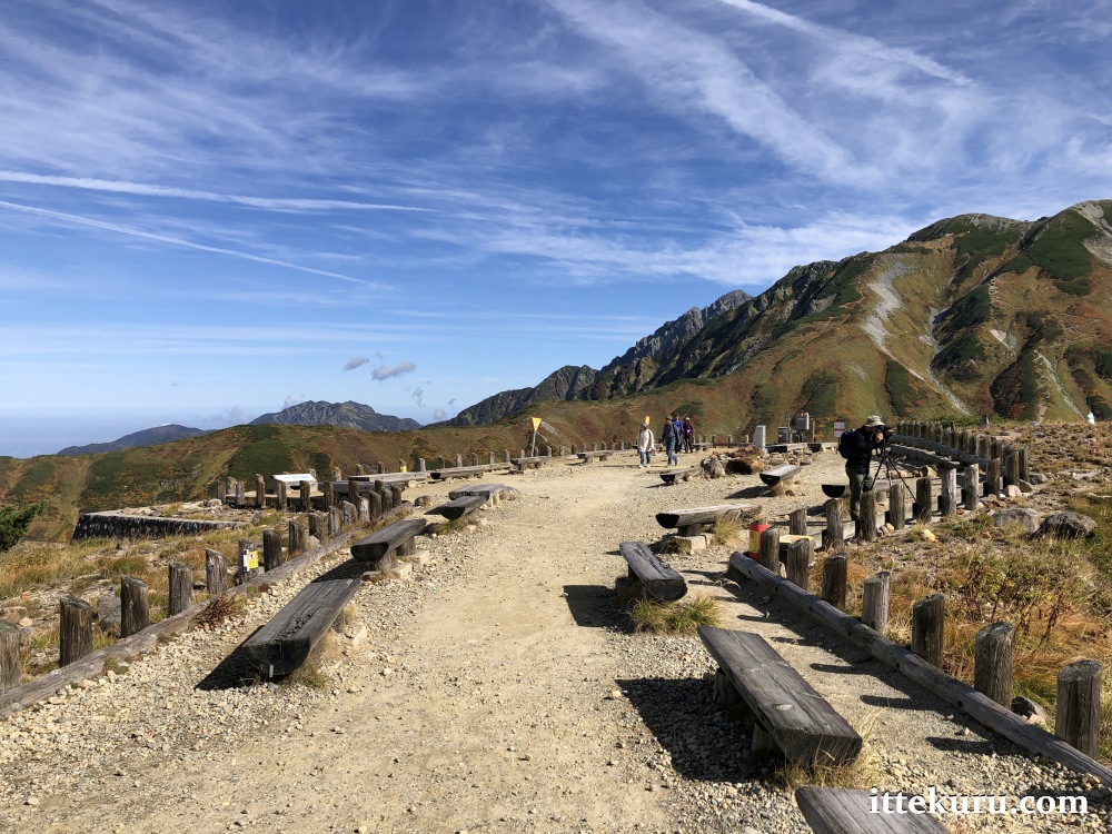
I began my walk from the small open area near the terminal building. There’s a large mounted map here if you’d like to get orientated (partly visible on the right side)…

…along with yet another warning sign. As I mentioned earlier, the easier routes on the plateau shouldn’t pose much of a challenge – but the mountain trails are no joke. If you’re not adequately prepared to tackle the slopes (especially during winter), think twice before hitting the advanced courses.

If you’re using the walking map on the Alpine Route website as a reference, note that the course I followed is the “Mikurigaike pond loop” (green line): a 1.7-kilometre, roughly 1-hour trail with a 1/3-star difficulty rating. Needless to say, the time required will depend in large part upon one’s preferred pace, the number of photo/break stops and so on; I for one took about an hour and a half for the whole loop.
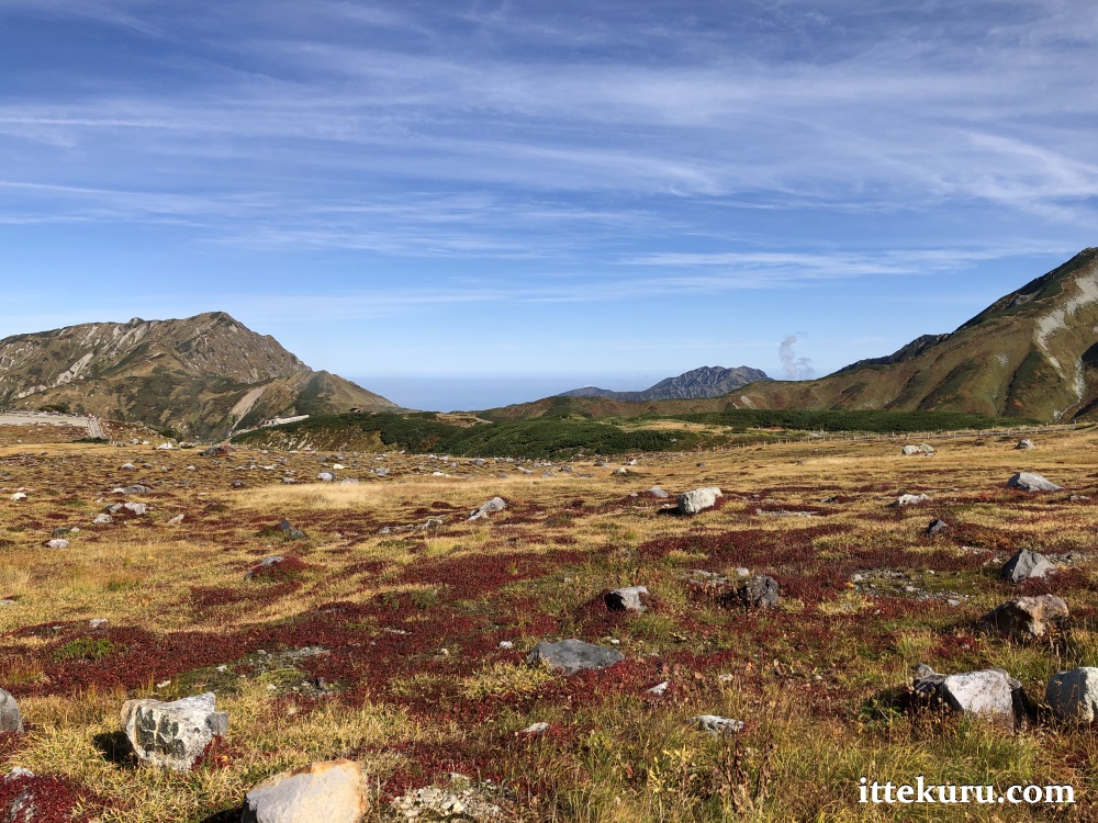
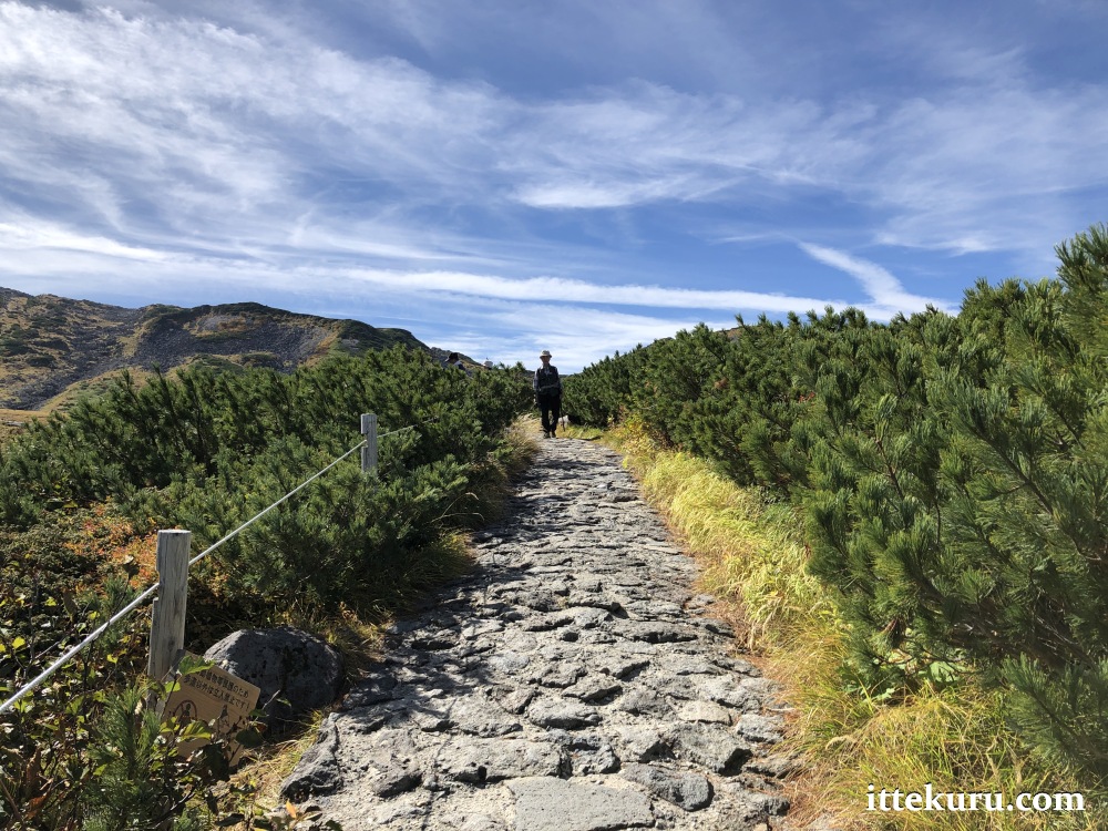
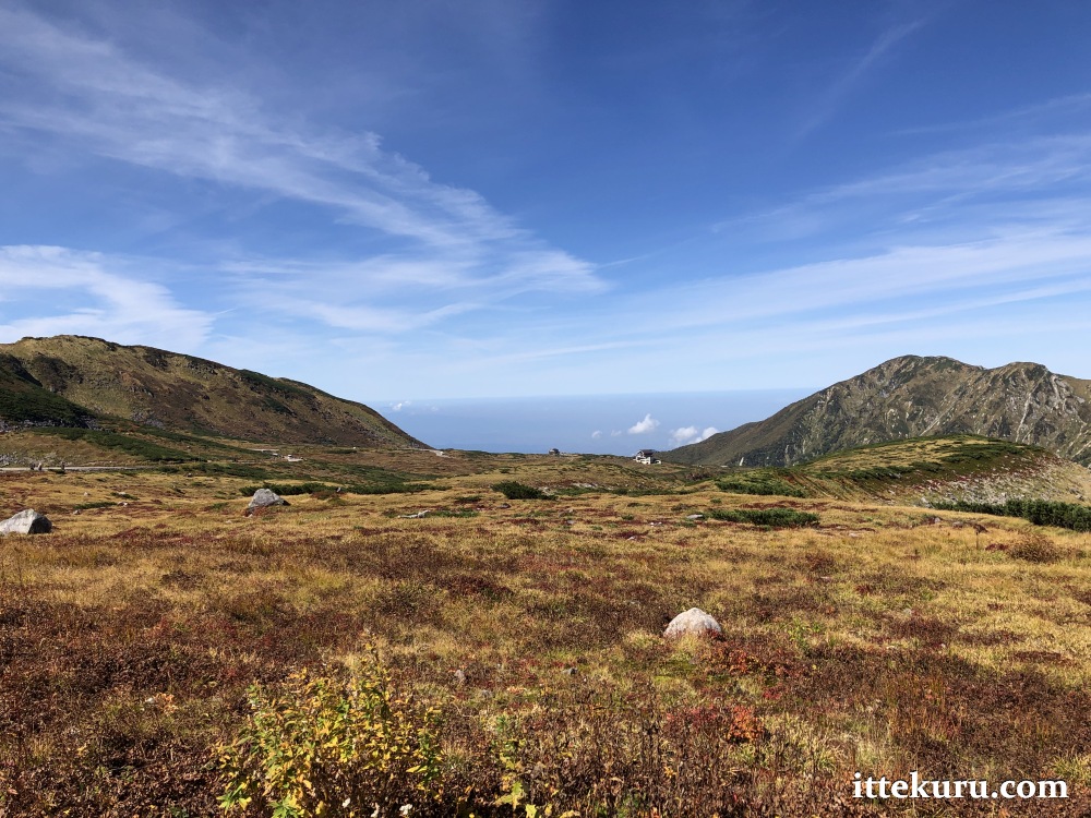
The first part was no challenge at all. Stone-paved paths laid across relatively flat terrain.


The plants on either side of me had long shed their summer green and were starting to put on autumn colours. Leaves of copper and blades of gold, with rocks appearing as nuggets of weathered silver strewn across the landscape.

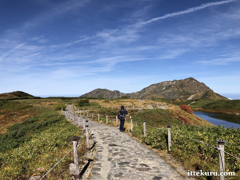
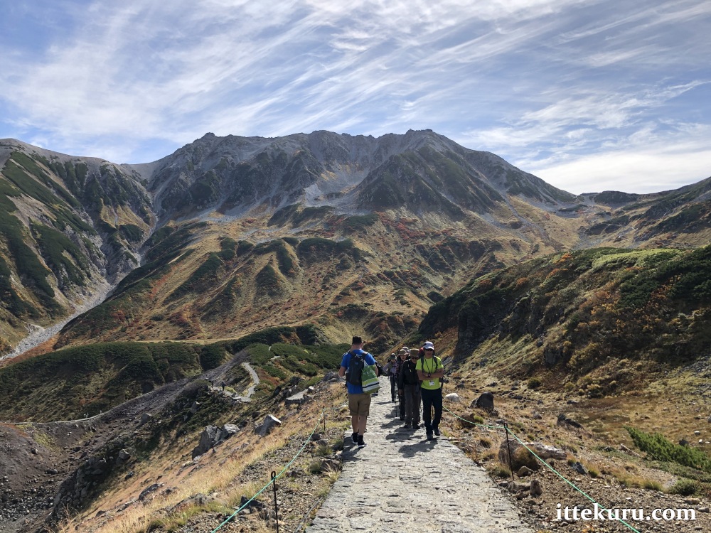
A few steps past the Tateyama Murodō Sansō (one of several accommodation options in this area), the path began to take on a more varied character. Down, then up again, but on fairly gentle inclines.
The highlight of this segment: a fantastic view of the mountains across the valley. That’s Tateyama (立山, 3015 m) with its three peaks on the right, Masagodake (真砂岳, 2861 m) in the middle, and Bessan (別山, 2880 m) on the left. Incidentally, all of the images in this post can be clicked on to access larger versions, but I especially recommend viewing this particular picture at full size.

Autumn was on the march here as well, with summer’s green in full retreat and yielding the lower slopes to shades of red and yellow.

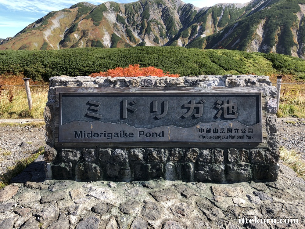
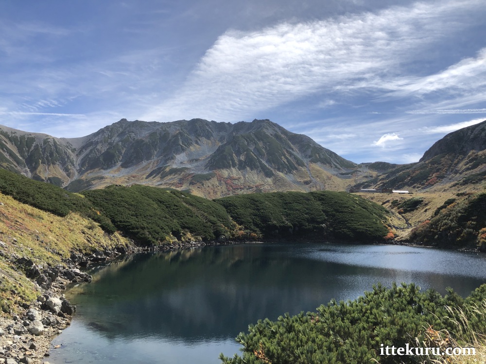
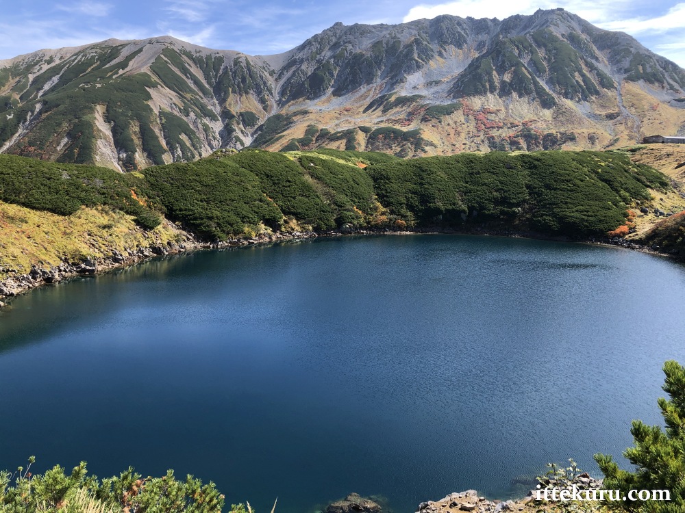
The path soon levelled out as I approached Midori-ga-ike (ミドリガ池), a small crater lake filled with clear mountain water. These next few pictures are of the pond itself or of the surrounding landscape as seen from near its shores.


Continuing northwest, I spotted the larger Mikuri-ga-ike pond to my left … but we’ll get a better look at that later.

After passing Midori-ga-ike, I looked down into the valley on my right and spotted the so-called Chi-no-ike (血の池) – literally, “Blood Pond”. This consists of a patch of wetland sprinkled with small pools, the waters of which are tinted red by high levels of iron oxide. The unique colour of those ponds was only vaguely discernible from my vantage point; doubtless it would have been more apparent if viewed closer-to.


A quick look back at the trail we’ve just traversed. That’s the Tateyama Murodō Sansō building on the right, with Tateyama itself dominating the middle and left.
I kept walking towards the end of the path, then veered right and north – aiming for the hut in the picture below – just as the path itself took a sharp left to the south.
This simple yet attractive wooden building could have made for a nice café or rest house … but it was neither. (And there’s no lavatory inside, so don’t even ask.) The “mountain hut” was in fact a monitoring station, presiding over an area bristling with sensors and beacons and warning sirens.
![]()
The reason for its existence will be made clear very shortly.
I walked a few steps north and entered the Enma-dai platform: an unpaved lookout point with fantastic views of the surrounding landscape.
From here, I looked east towards Tateyama, with the Chi-no-ike wetland at its base…

…and then west, where the vista was beautiful on the one hand and just a wee bit alarming on the other.

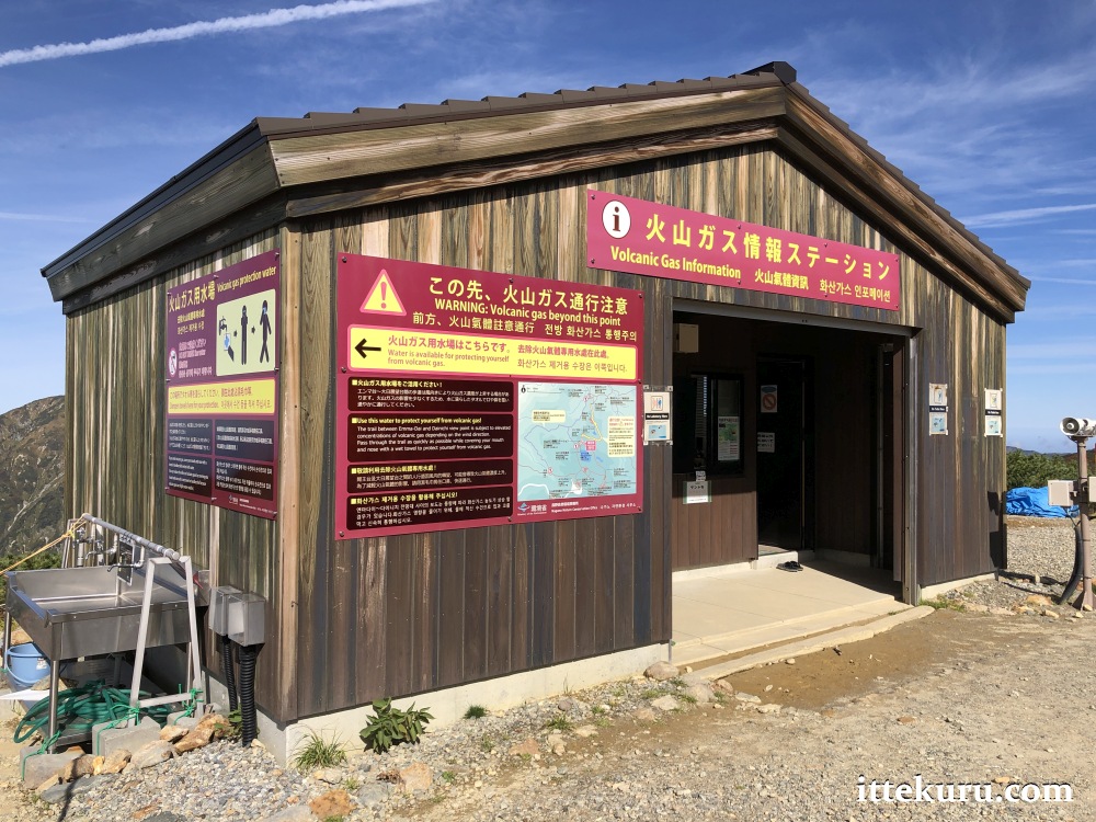
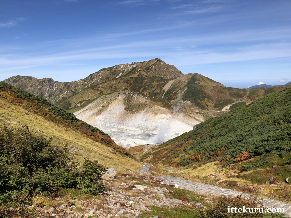
The ash-grey field far below me was Jigoku-dani (地獄谷), whose name – which literally means “Hell Valley” – seemed particularly apt under the circumstances. Even from my elevated vantage point, the smell of sulphur hung strongly in the air: the mingled breath of Jigoku-dani’s many hot springs and fumaroles.
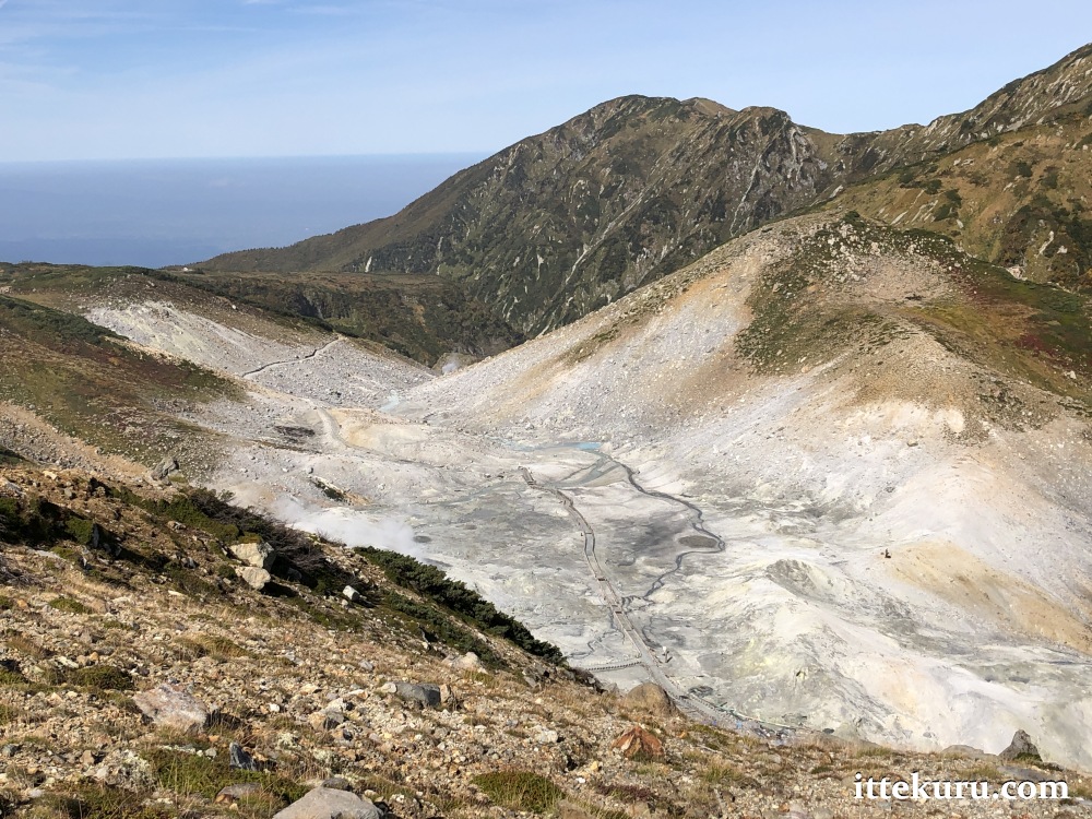
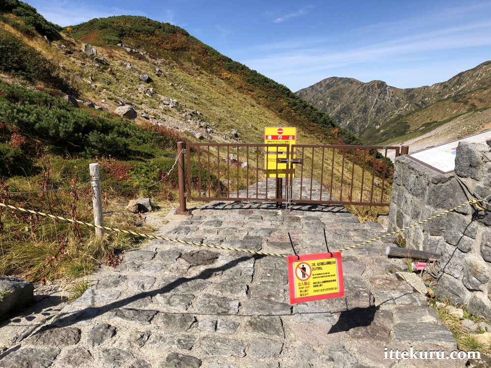
Zooming in a bit closer, I could clearly discern a network of walking trails snaking through the valley. Those would have made for a very interesting and almost otherworldly stroll, had they been open. Alas, an uptick in volcanic activity and increased gas concentrations have made Jigoku-dani rather dangerous indeed, and the paths are – for the moment – closed to visitors.
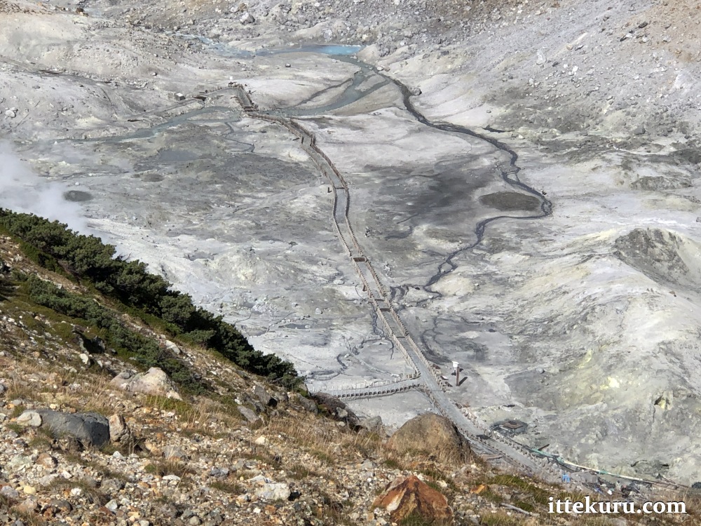
Part of the trail leading down to Jigoku-dani is still open, as far as the Raichōzawa campsite … though I ventured no further than the first few metres from Enma-dai.
It wasn’t the volcanic gas I was afraid of; after all, the alarms were silent and many other walkers were cheerfully heading down or back up. No, I was more concerned with running out of time (since I was hoping to complete my Alpine Route crossing by mid-afternoon) and running out of energy (especially on the long ascent back to Enma-dai).
In any event, whether staying put or going down, it pays to be mindful of the warning signs and alarm signals – as well as the location of the nearest emergency kit stocked with respirators. (Just in case.)

After taking in the view and enjoying a few moments of rest, I returned to the trail and followed it south. I didn’t stay on the path for very long, though…

…because I found myself almost immediately distracted by the Mikuri-ga-ike Onsen building.

I wasn’t in the mood for a hot soak, but I did feel the need for a snack. Into the lobby I went to see what was on offer.
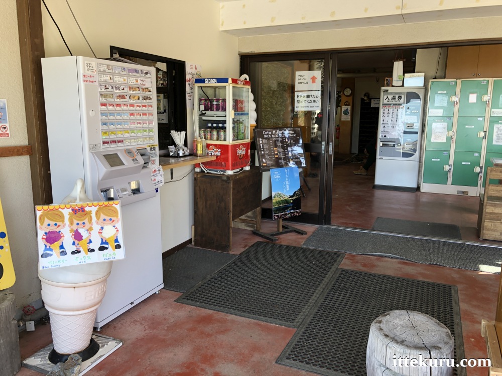
I gather from the extra-large labels that beer and coffee are especially popular. Poison and antidote, perhaps? 😉
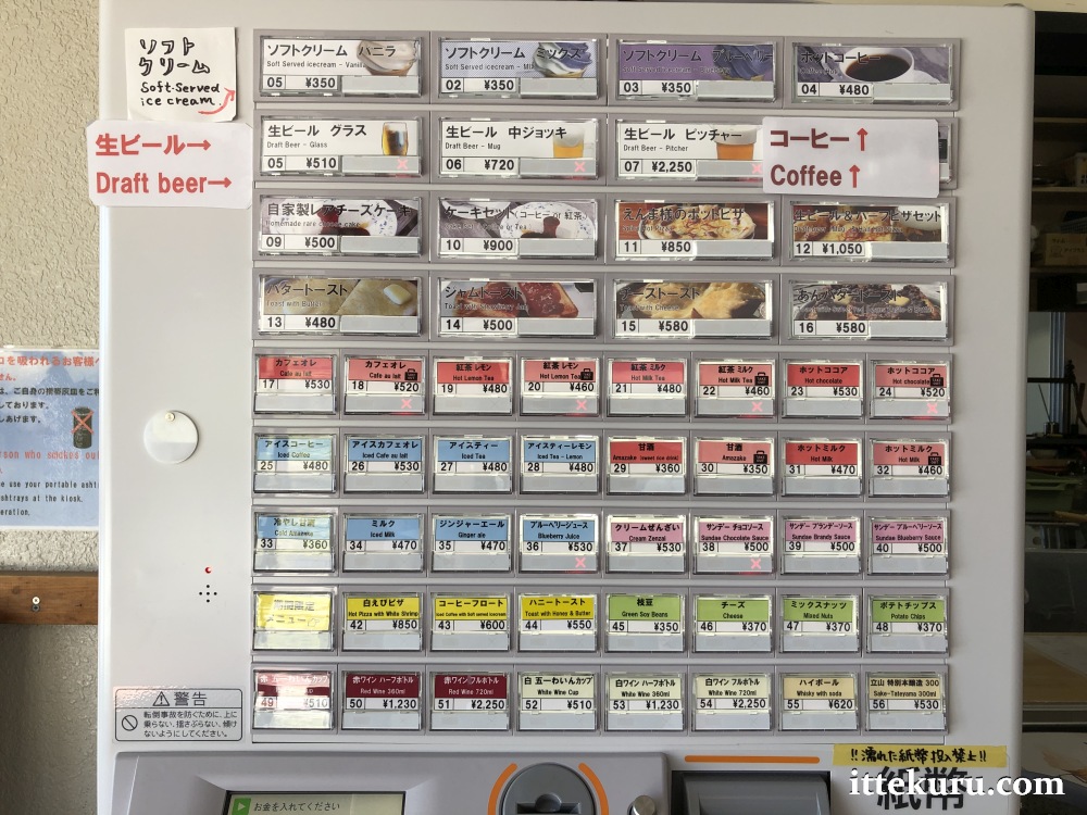
My selection from the snack bar: a little twirl of blueberry soft-serve ice cream (350 yen), which I enjoyed out on the building’s open-air rest area.


Great view from up here, with the steam-shrouded depths of Jigoku-dani far below and – beyond the valley – the majestic peaks of Dainichi-dake (大日岳, 2501 m) and Oku-dainichi-dake (奥大日岳, 2611 m).

After leaving the onsen, I passed another entrance to the Jigoku-dani trail. Like all other paths leading down to the valley, this was presently closed and barred to all visitors.

Not to worry – one merely has to turn around in order to find more of the area’s natural beauty.
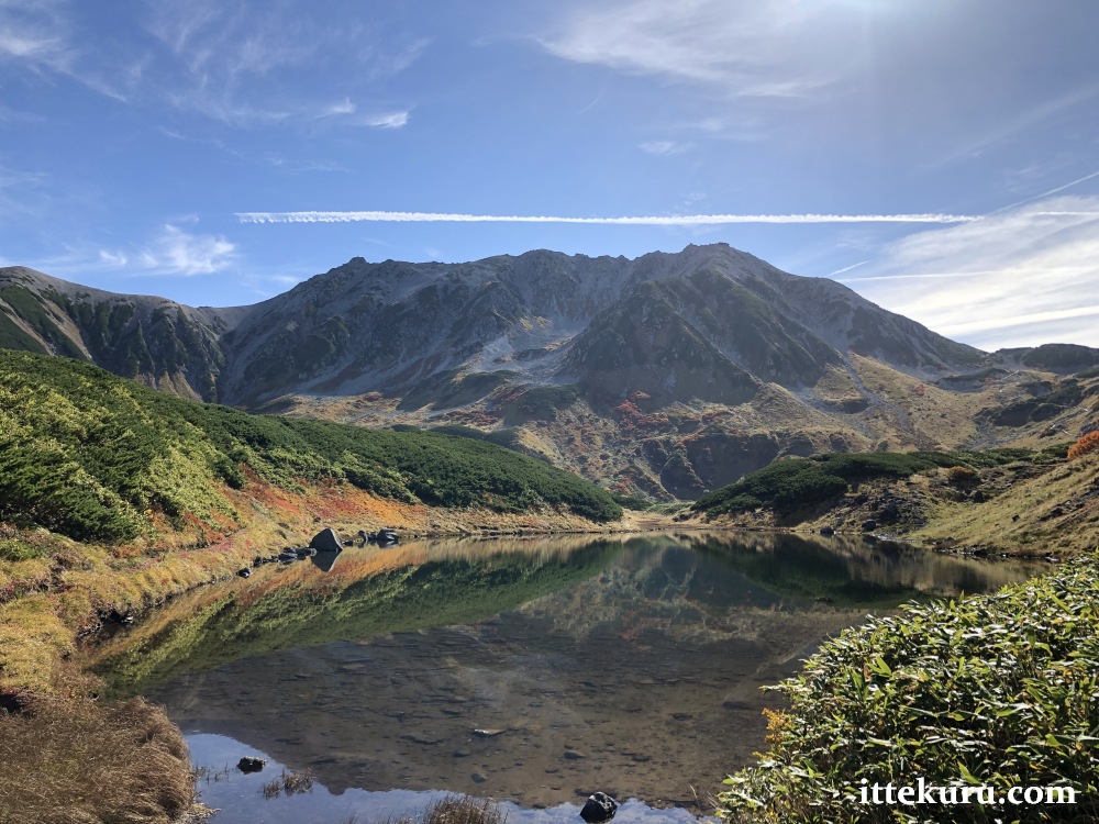
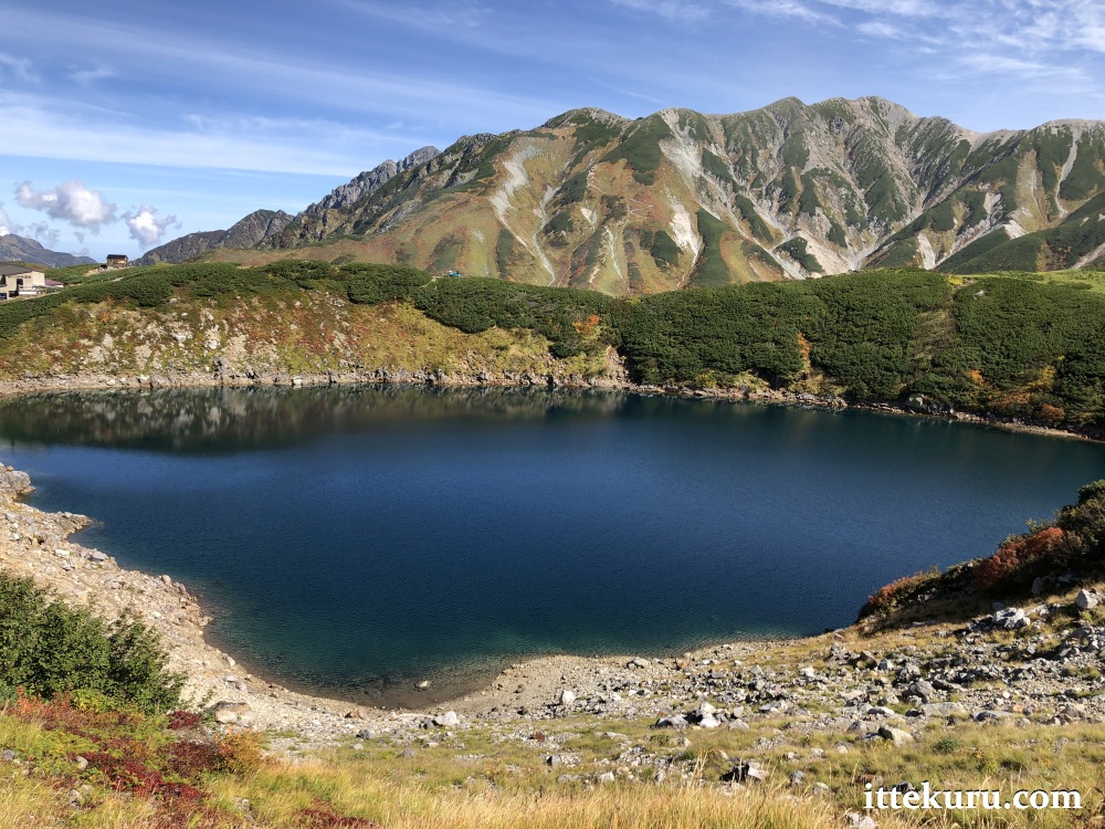
Here we have another of Murodō’s crater lakes, with Tateyama serving as a grand natural backdrop. Larger and deeper than Midori-ga-ike, Mikuri-ga-ike (ミクリガ池) is a focal point for some of the easier walking routes that loop around the plateau.

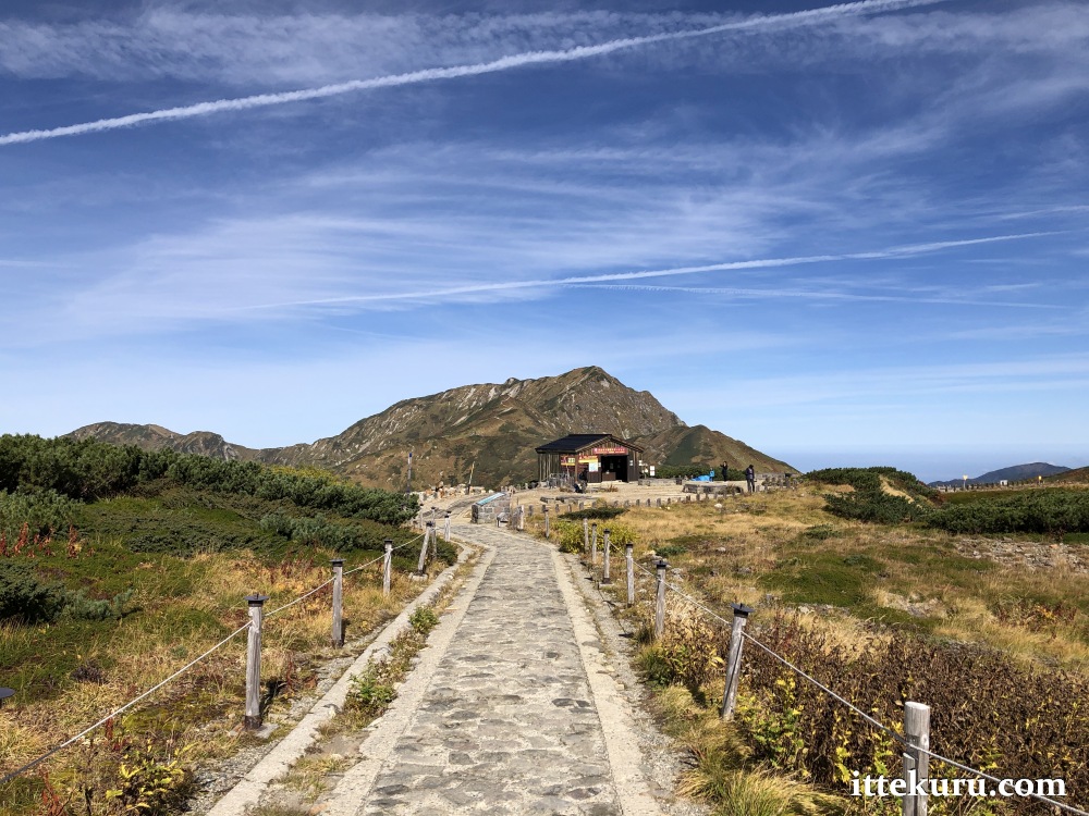
From here, the path continued southwards all the way back to Murodō terminal. The next pictures were taken along that segment, looking forwards and back and to either side; the pond visible in the pictures below is Mikuri-ga-ike.


Before long, I passed through the same meadow I’d seen on the first stretch of the trail: a reminder that my time in Murodō was drawing to an end.
After returning to the terminal, I descended to Murodō Station deep in the basement and caught a tunnel bus service to Daikanbō (the last leg described in this post). From there, I continued on through the remainder of the Alpine route (as outlined in this post), stopping off at the Kurobe Dam before completing the journey in faraway Nagano.
And there we have it. A great day in the great outdoors: splendid weather, cool mountain air, an invigorating stroll whilst surrounded by incredible natural beauty. Count me as one very happy walker. 🙂
Cheerio.

2 thoughts on “Field Report: Walking Around the Murodō Plateau, Toyama Prefecture, Japan (01 October 2019)”