

Fresh off the first few legs as described in Part 1, we’re now ready to complete our crossing of the Tateyama Kurobe Alpine Route (立山黒部アルペンルート) by setting out on the long way down, starting at Daikanbō.
Note: This report is based on my own experience of travelling across the Tateyama Kurobe Alpine Route on 01 October 2019. Fares, timetables, operating dates/hours and other details may change anytime without prior notice.
If you’ve come to this post directly, please have a look at Part 1 first as it contains important background information that’s not repeated here.
Let’s have a look at the route. Small point: “Ōgizawa” is the official reading of the last station’s name (扇沢), rather than “Ōgisawa” as labelled below. (It’s a quibble, to be sure, and I still give the map’s creator high marks for preparing this excellent visual overview.)

Part 1 covered the first four legs, from Toyama all the way to Daikanbō. Part 2 focuses on the remaining segments, from Daikanbō to Ōgizawa and further on to Nagano.
All right, we’re properly orientated. Let’s continue from where we left off at the end of my last post.
FIFTH STAGE OF THE CROSSING: DAIKANBŌ TO KUROBEDAIRA ON THE TATEYAMA ROPEWAY
Change in elevation: From 2,316 to 1,828 metres above sea level
Scheduled departure: 1050
Scheduled arrival: 1057
After a ten-minute journey through the narrow tunnel, the trolleybus pulled up at Daikanbō Station (大観峰駅, Daikanbō-eki).
I rushed upstairs, determined to join the next queue straightaway … but something lured me to the edge of a viewpoint between the trolleybus platform exit and the station building’s entrance.
Oh come now, who wouldn’t be distracted by something like this?

A set of stairs inside the building led up to an even higher observation deck, designed as a series of terraces overlooking the mountain slope.
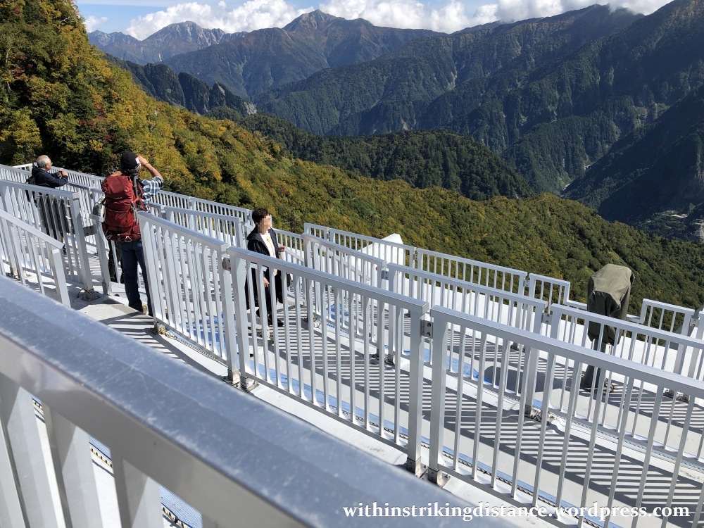

Down in the boarding area, the converging queues for both directions threw me off initially – but I quickly found the green lines leading to the correct gate.


After the passengers waiting for the 1050 departure (myself included) were allowed onto the platform, I glanced over the edge and was treated to a rather dizzying sight.

The blue speck in the distance gradually increased in size, revealing itself to be one of the cable cars serving the Tateyama Ropeway line.
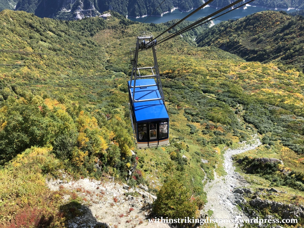
Obviously we made it down safely – or I wouldn’t be here typing out this post 😉 – but at the time, the slightly flimsy appearance of the connecting apparatus between car and cable didn’t inspire much confidence.

Buses on roads or funiculars on tracks are one thing. A 1.7-kilometre cable span with no intermediate supporting pylons is quite another … especially in the eyes of a chap with a (mild) fear of heights. In the end, my disappointment over not being able to secure a place in the front – where the best downward views could be enjoyed – was tempered by the less intimidating rearward-facing vista.

SIXTH STAGE OF THE CROSSING: KUROBEDAIRA TO KUROBEKO ON THE KUROBE CABLE CAR
Change in elevation: From 1,828 to 1,455 metres above sea level
Scheduled departure: 1110
Scheduled arrival: 1115
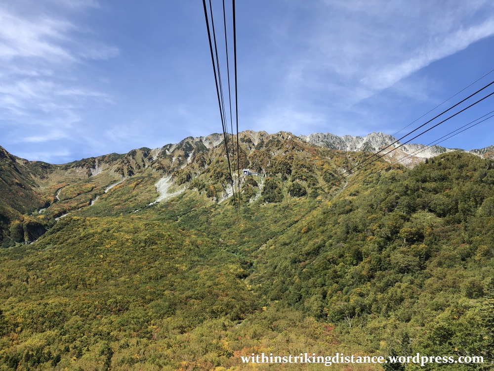
After a few, er, gripping minutes of barely-supported air travel, the cable car finally docked safely in its berth at Kurobedaira Station (黒部平駅, Kurobedaira-eki).
Here I transferred to a somewhat less fear-inducing mode of transport: the Kurobe Cable Car.


Off we went, rolling our way along a steeply sloped tunnel. I’ve read that this is the only fully underground cable car line in Japan.


The short funicular ride took me nearly 400 metres closer to sea level, down to Kurobeko Station…
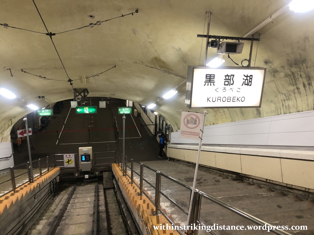
…where, after disembarking, I finally managed a better look at the vehicle that had brought me there.


SEVENTH STAGE OF THE CROSSING: KUROBEKO TO KUROBE DAM STATION ON FOOT
Change in elevation: From 1,455 to 1,470 metres above sea level
Scheduled departure: whenever you like
Scheduled arrival: depends on how fast your feet will bear you (and how long you linger at the Kurobe Dam)
Amongst all the modes of transport used on the Tateyama Kurobe Alpine Route, the one employed for this stage is perhaps the most environmentally friendly. (Unless you’re the sort to eat coal for breakfast and sip gasoline in place of tea.) It’s also the only one for which you have complete control over speed, direction, and even timetables.
After all, it requires you to WALK from one station to the other. 😉
At Kurobeko Station (黒部湖駅, Kurobeko-eki)…
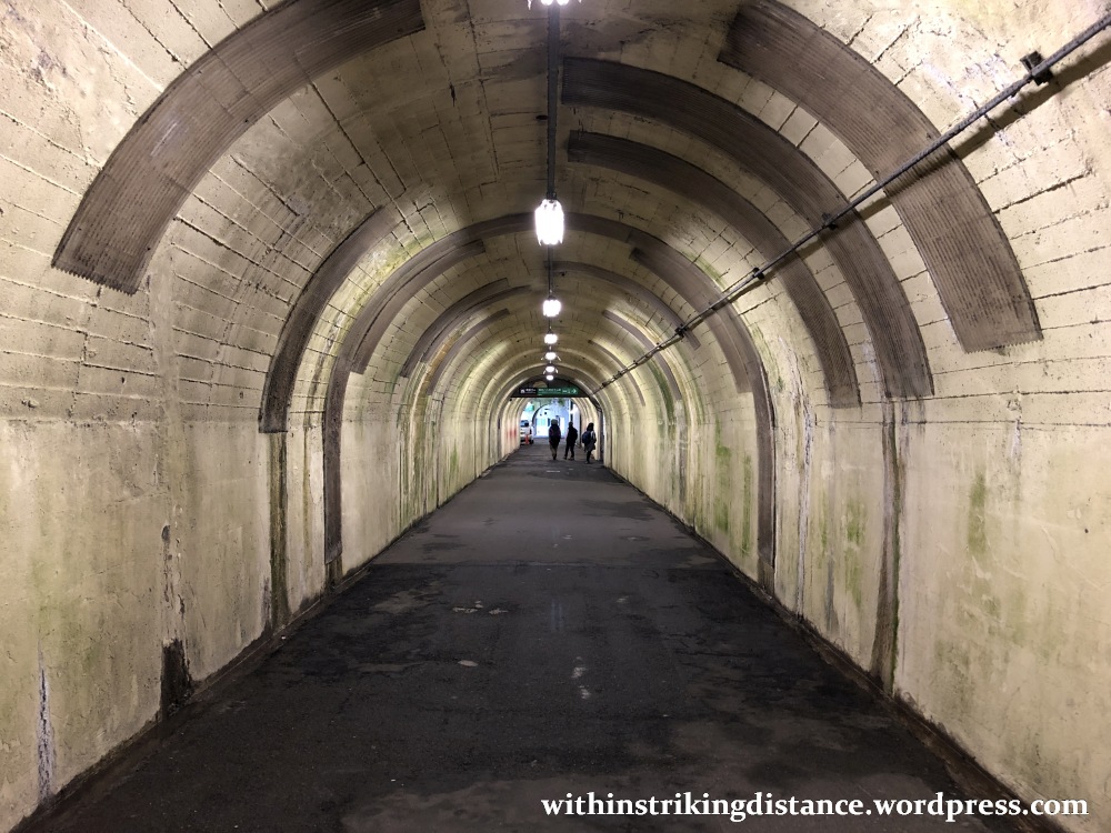
…I followed the signs and headed down a long tunnel with massive steel doors at one end.

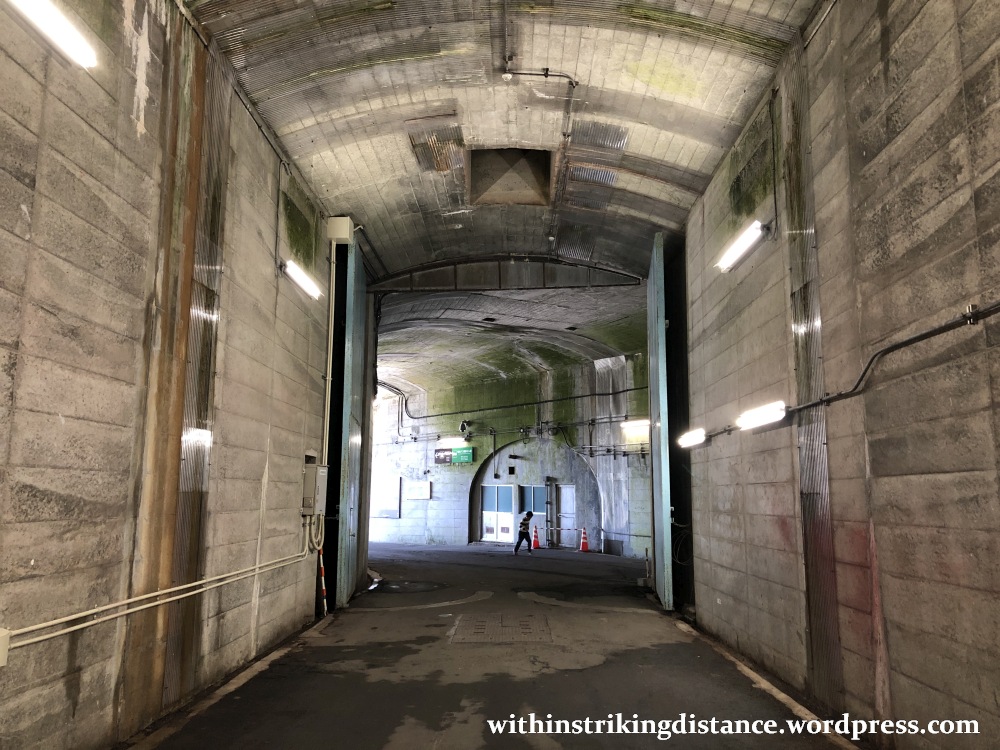
Emerging into the bright autumn sunshine, I soon found myself walking on top of the Kurobe Dam itself.


I’ve got many other pictures to share of this scenic location, but let’s save them – and the tale of what I saw and did at the dam – for a separate post.
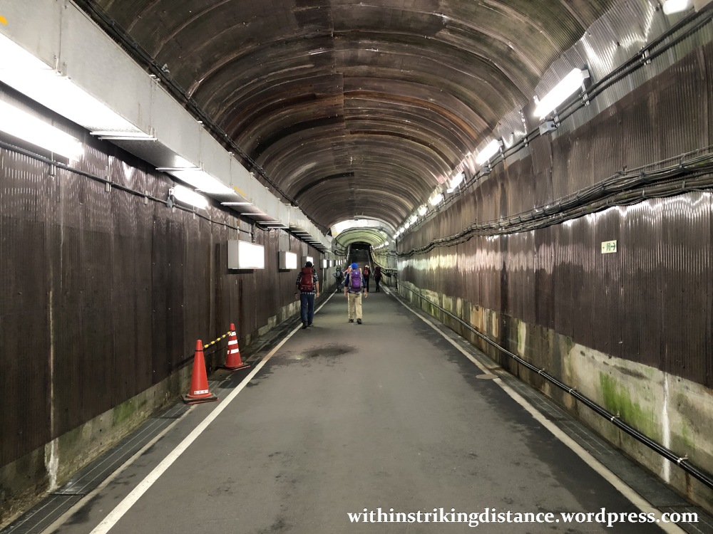
I spent over an hour at the dam (sightseeing plus a quick lunch), then entered the long tunnel at the dam’s eastern end…


…and began walking towards the boarding point for the next stage of my journey.

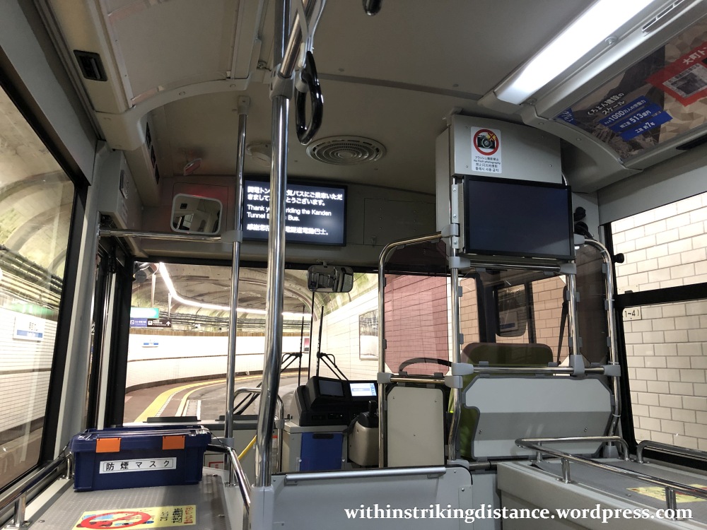
EIGHTH STAGE OF THE CROSSING: KUROBE DAM STATION TO ŌGIZAWA ON THE KANDEN TUNNEL ELECTRIC BUS
Change in elevation: From 1,470 to 1,433 metres above sea level
Scheduled departure: 1305
Scheduled arrival: 1321
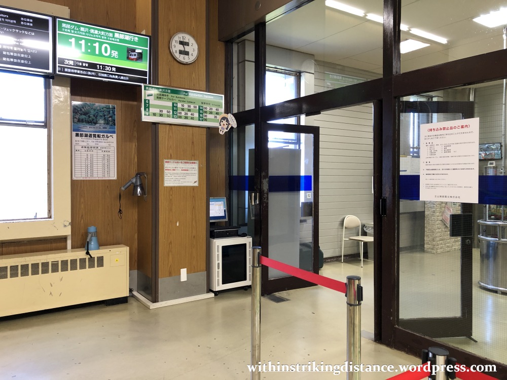
Soon, I was standing near the boarding gate at Kurobe Dam Station (黒部ダム駅, Kurobe Damu-eki).

The route between here and Ōgizawa was formerly served by the Kanden Tunnel Trolleybus, which was one of the last two trolleybus lines still running anywhere in Japan. (The other was the Tateyama Tunnel Trolleybus, which we saw earlier in my description of the fourth stage of the Alpine Route.) After more than half a century in service, the Kanden Tunnel Trolleybus ceased operating in November 2018, leaving its sister Alpine Route service in the Tateyama Tunnel as the very last of their breed. Starting with the 2019 season, the line has been served by electric buses, like the one shown below.

NINTH STAGE OF THE CROSSING: ŌGIZAWA TO NAGANO VIA HIGHWAY EXPRESS BUS
Change in elevation: From 1,433 to 361 metres above sea level
Scheduled departure: 1340
Scheduled arrival: 1525
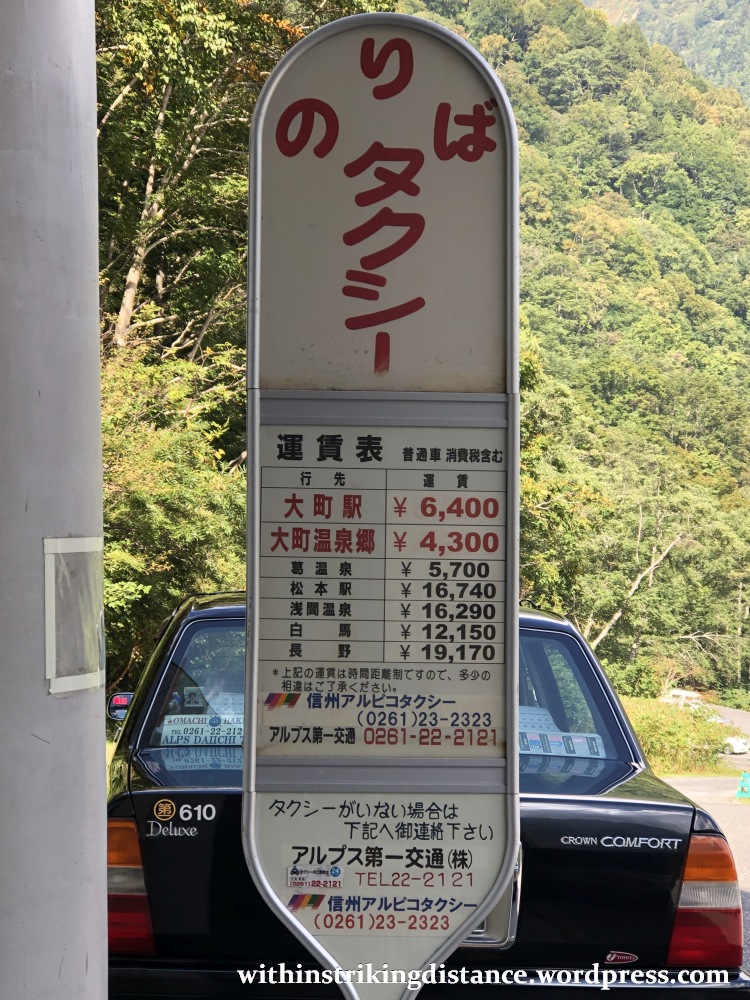
I got off the electric bus at Ōgizawa Station (扇沢駅, Ōgizawa-eki).
Nice, scenic mountain setting. Shame about the ginormous parking lot.

From here, local bus services whisk people off to Shinano-Ōmachi Station, which is the eastern terminus of the Tateyama Kurobe Alpine Route. Those requiring private transport can also hire a taxi, but they’ll need to pay dearly for the privilege.
Of course, a good number of visitors – myself included – will be heading not for Shinano-Ōmachi, but for distant Nagano: the nearest stop on the Hokuriku Shinkansen line. You’ll want to board an express/highway bus (not a local bus) if Nagano is your intended stop.


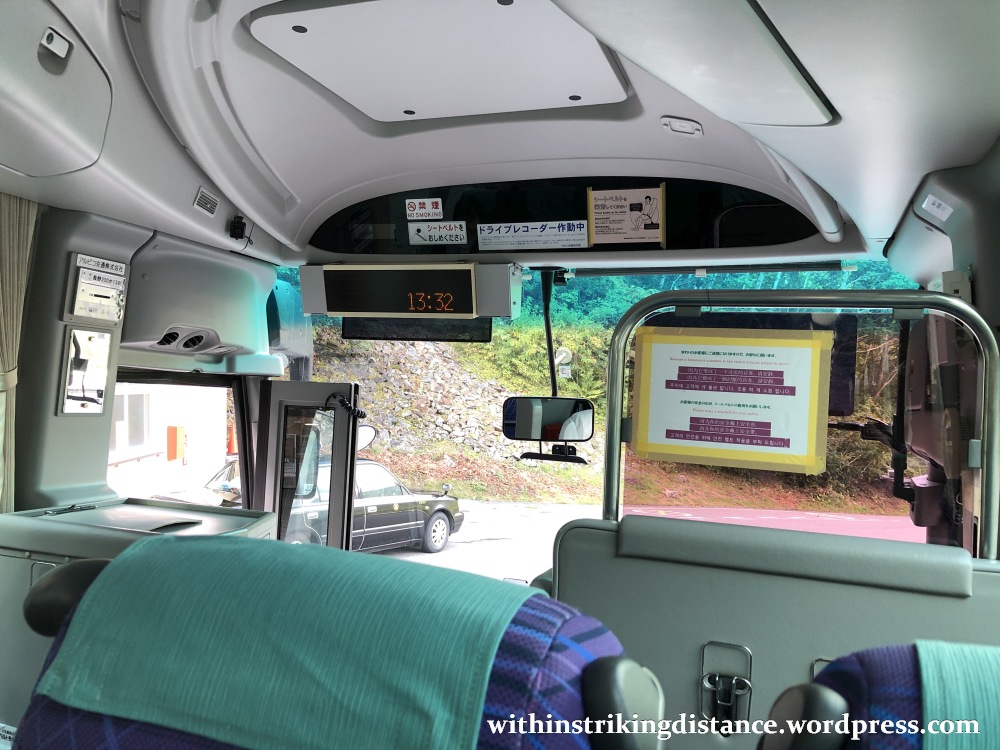
The highway bus is fully covered by the Tateyama Kurobe Option Ticket, and there’s no need to redeem it for a separate bus ticket here at Ōgizawa. Just walk straight to the designated stop, show the Option Ticket to the driver (i.e., the original green ticket itself, not the bar-coded Alpine Route ticket issued at Tateyama), and hop aboard.
FINAL STAGE: HOMEWARD BOUND FROM NAGANO TO TOYAMA
After the nearly 2-hour bus ride, I finally arrived at Nagano Station (長野駅, Nagano-eki).
As a key stop on the Hokuriku Shinkansen line – and a worthwhile sightseeing destination in its own right – Nagano makes a good end point for a full Alpine Route crossing. Your options at this point include staying in the city, heading east on the shinkansen to Tōkyō, or proceeding west towards Kanazawa (or even Kyōto and Ōsaka further beyond).

For myself, a westward journey back to my base at Toyama was the finishing leg of this incredible day.

And there we have it! A splendid day in the great outdoors, all made possible by the unique scenic corridor that is the Tateyama Kurobe Alpine Route.
I’ll be back soon to write about my stopover at the Kurobe Dam, which will be followed by another post describing my earlier stopover at Murodō.
Until then, cheerio.

3 thoughts on “Field Report: Tateyama Kurobe Alpine Route, Part 2 (Descent from Daikanbō to Ōgizawa and Nagano)”