

Though it’s best known for breathtaking natural landscapes, the scenic Tateyama Kurobe Alpine Route also includes a stop at an important man-made landmark. Completed more than half a century ago, the tallest arch dam in Japan was a major engineering feat of its time, with construction taking a heavy toll in both resources and human life. Today, it not only generates electricity but also draws visitors to this beautiful corner of the Hida Mountains, offering an interesting contrast to the spectacular scenery that surrounds it.
Welcome to the Kurobe Dam (黒部ダム).
My brief stopover at this landmark was just one slice out of a full journey across the Tateyama Kurobe Alpine Route (立山黒部アルペンルート): a network of trains, funiculars, buses, and aerial lifts that spans the Hida Mountains between Toyama and Nagano Prefectures.
Small point: “Ōgizawa” is the official reading of the last station’s name (扇沢), rather than “Ōgisawa” as labelled below. (It’s a quibble, to be sure, and I still give the map’s creator high marks for preparing this excellent visual overview.)

Read more about my Alpine Route crossing in these related posts:
Right, let’s proceed.
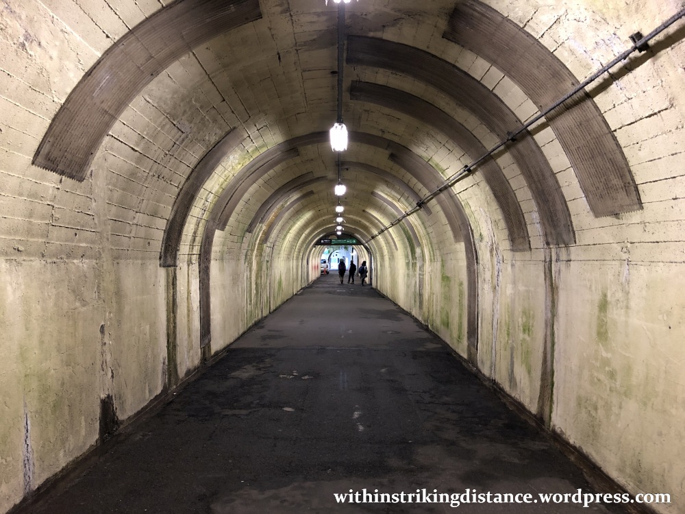
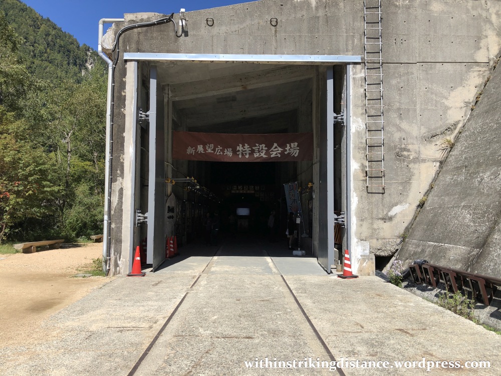
After stepping off the Kurobe Cable Car at Kurobeko Station…

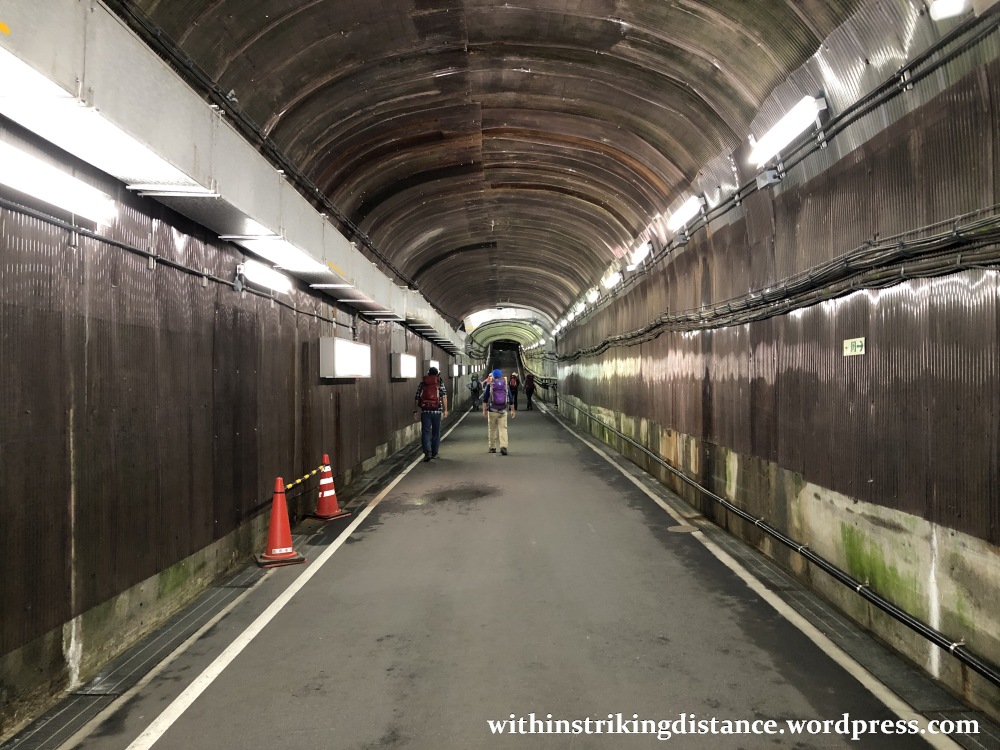
…I followed the signs and headed down a long tunnel with massive steel doors at one end.

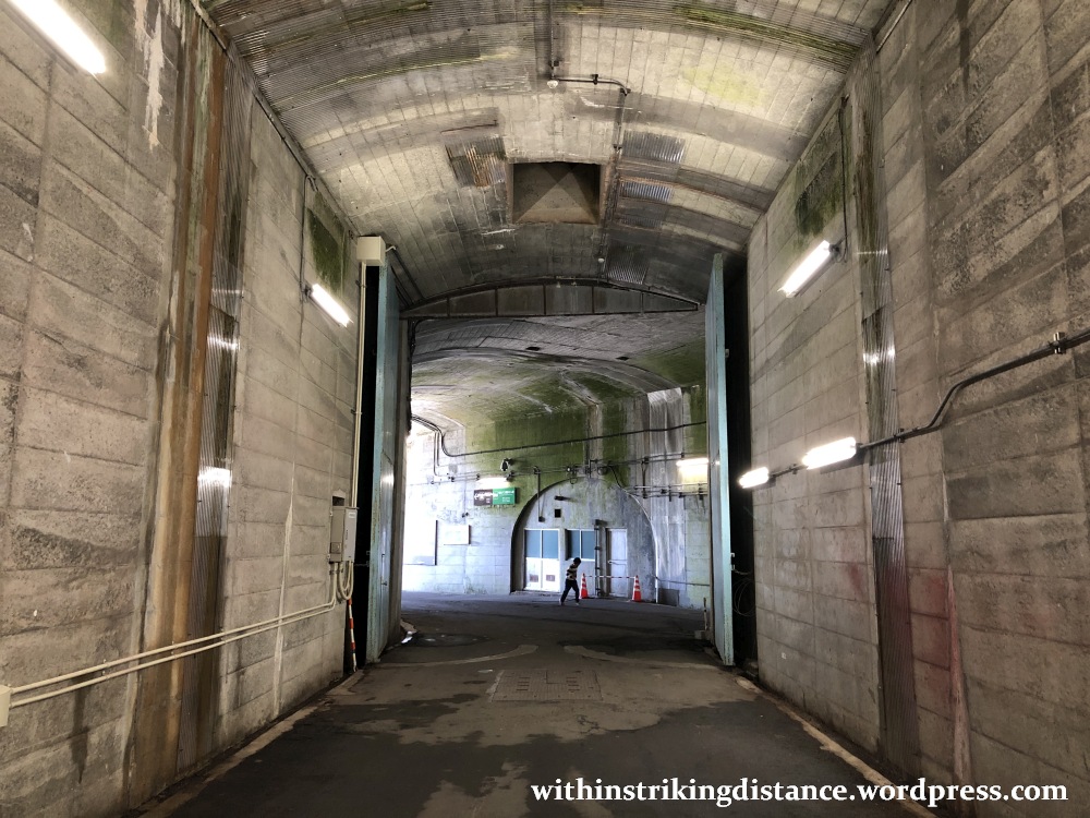
Emerging into the bright autumn sunshine, I started to make my way down a paved road with stout metal railings on either side.
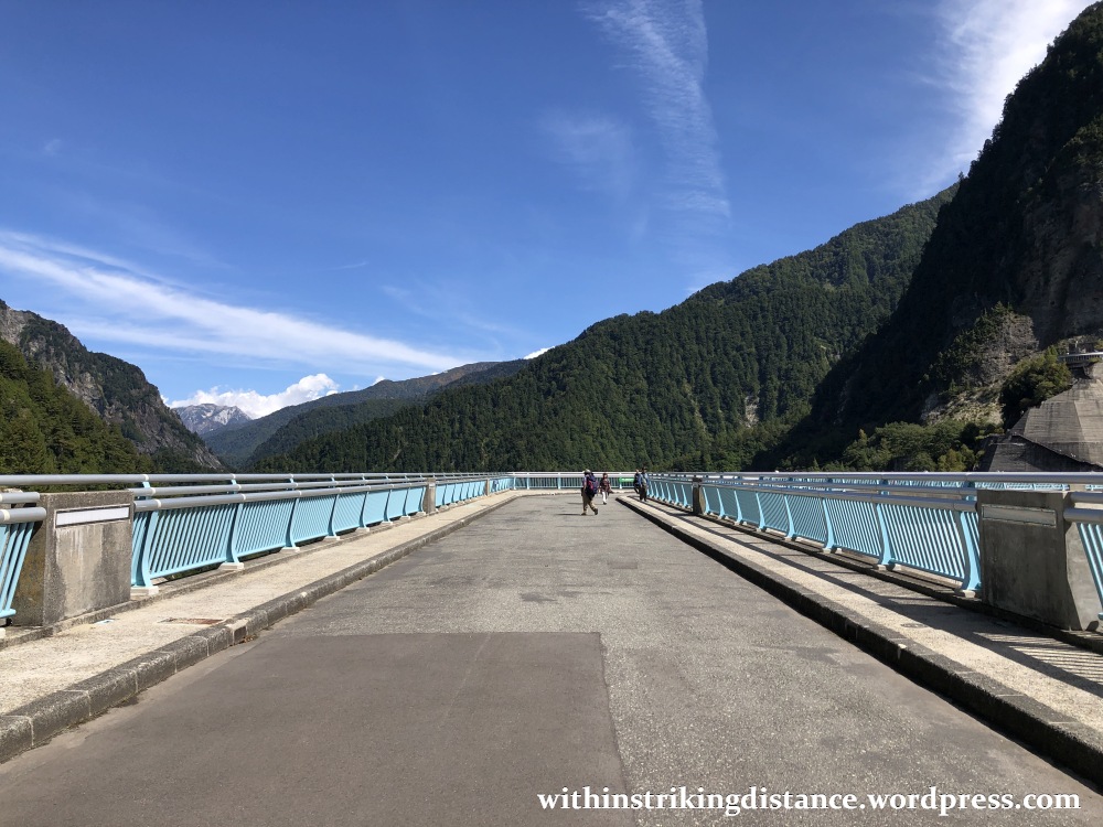

At this point, one might begin to wonder where the dam is…
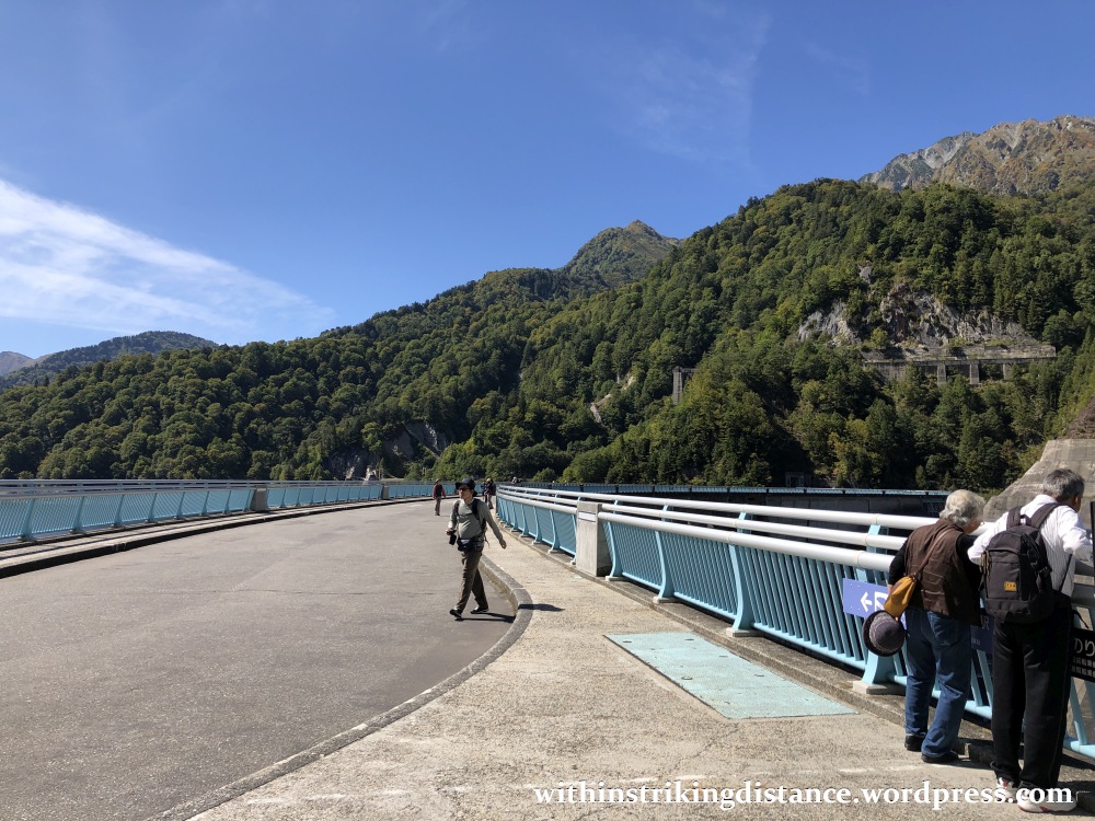
…until one glances over the side, and realises that the “road” IS the dam.

That’s the reservoir-side face, of course. We’ll have a better look at the “front” of the dam later.
There are great views to be had on either side of the concrete wall. To the south, facing upstream, is Lake Kurobe (黒部湖, Kurobe-ko): the man-made reservoir created from the penned-up waters of the Kurobe River.
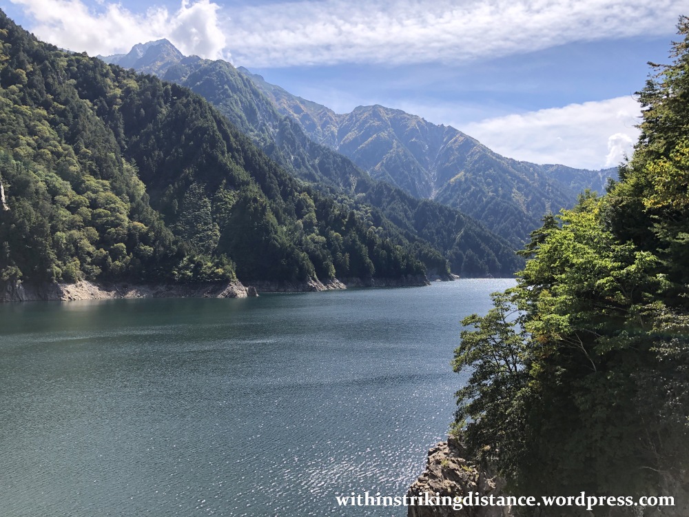
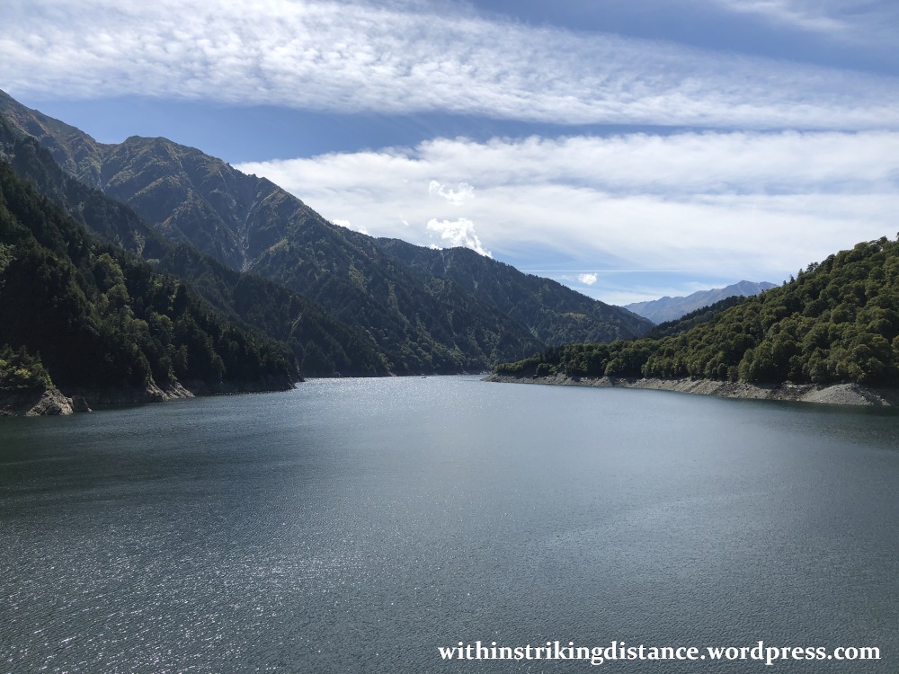
We’ve already seen the lake in my previous post, albeit from the elevated vantage point of Daikanbō Station (the upper terminus of the Tateyama Ropeway). Kurobe Dam is on the left side, not quite visible although the concrete structures overlooking the dam itself can be made out.

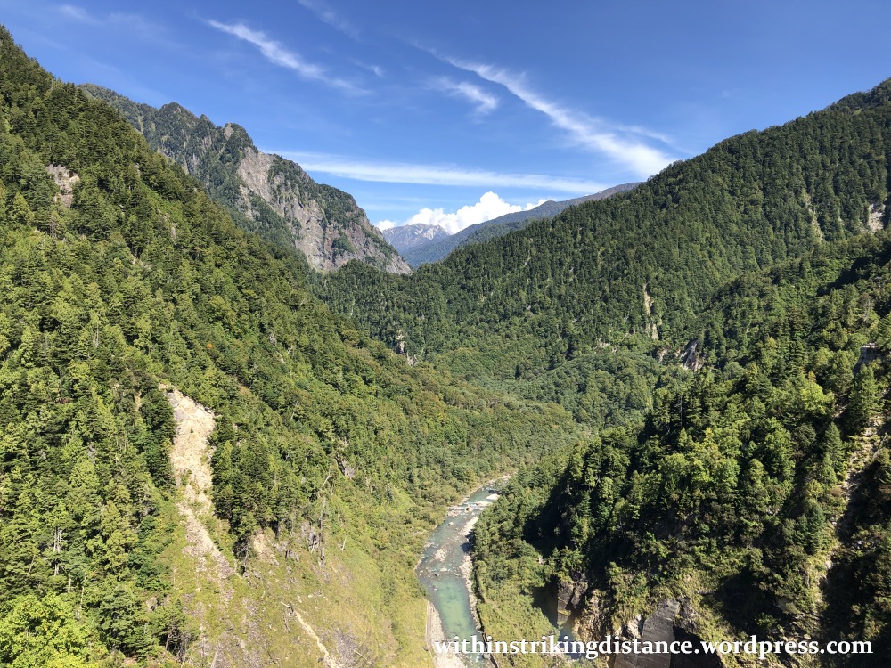
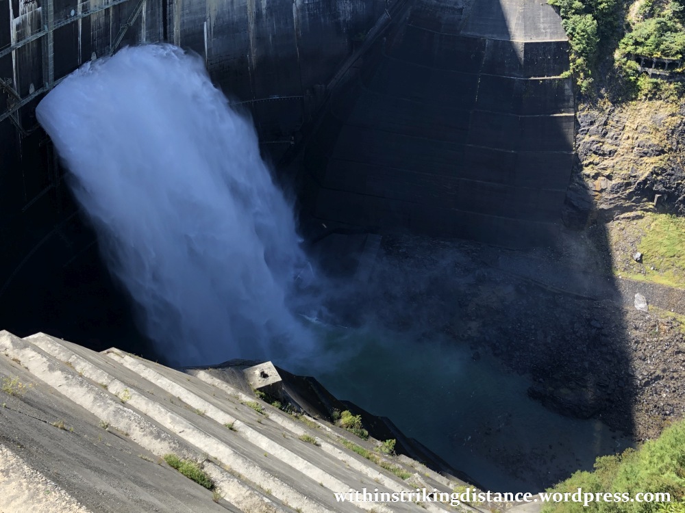
Looking north, facing downstream, one is rewarded with a glimpse of the untrammelled Kurobe River and the thickly forested slopes rising up from either bank.
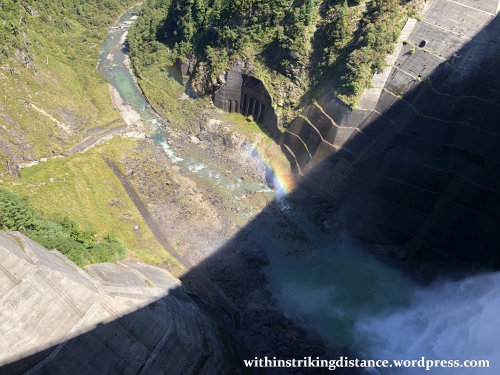
Glancing down this side of the wall, I spotted a faint rainbow floating in the mist thrown up by the dam’s powerful water discharge.
Let’s keep going. Incidentally, the walk from the western end of the dam wall to the eastern side is itself one of the stages of the Tateyama Kurobe Alpine Route. You can’t do a full crossing without completing this, er, rite of passage. (Haha.)
And as a reward for completing the arduous trek (read: childishly easy stroll on a perfectly flat stretch of concrete), I allowed myself a bottle of chilled coffee milk from the snack counter near the walkway.

Ahh. Refreshing.
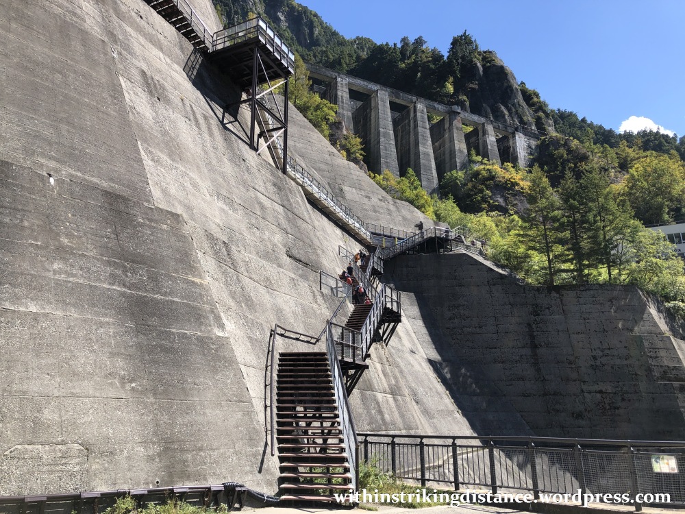
After my coffee break, I walked a short distance north in the shadow of the concrete-encased cliff above the dam, eventually coming to a decision point.
Keep to the right and ascend to an upper observatory with sweeping views of the dam and lake, or go down the steps on the left for a closer view of the dam face and its water discharge?
The prospect of an exhausting climb didn’t seem particularly appealing to me (not that a climb of any sort ever does), so down I went.


There’s also a small exhibition hall near the lower observatory featuring displays related to the construction of the dam.
Now I may have dodged a long uphill climb earlier, but there was no avoiding it now.
Aaaaargh.
It probably doesn’t look like a very long slog in that picture – and indeed it wasn’t – but I’m not as fit as I should be and getting back up was a bit of a struggle. It wasn’t just the physical effort required: I suffer from a (mild) fear of heights and the metal staircase’s rather precarious position along the concrete cliff wall inspired more terror than it did determination.
And so, after that perilous ascent (read: a routine upstairs dash mutated into a dangerous cliff-side climb by my coward’s imagination), I headed up to the second level of the Kurobe Dam Rest House…
…for a break and a spot of lunch.
There’s a souvenir shop up there, as well as an old-fashioned cafeteria serving some hearty main courses.
Here’s a shot of the menu.
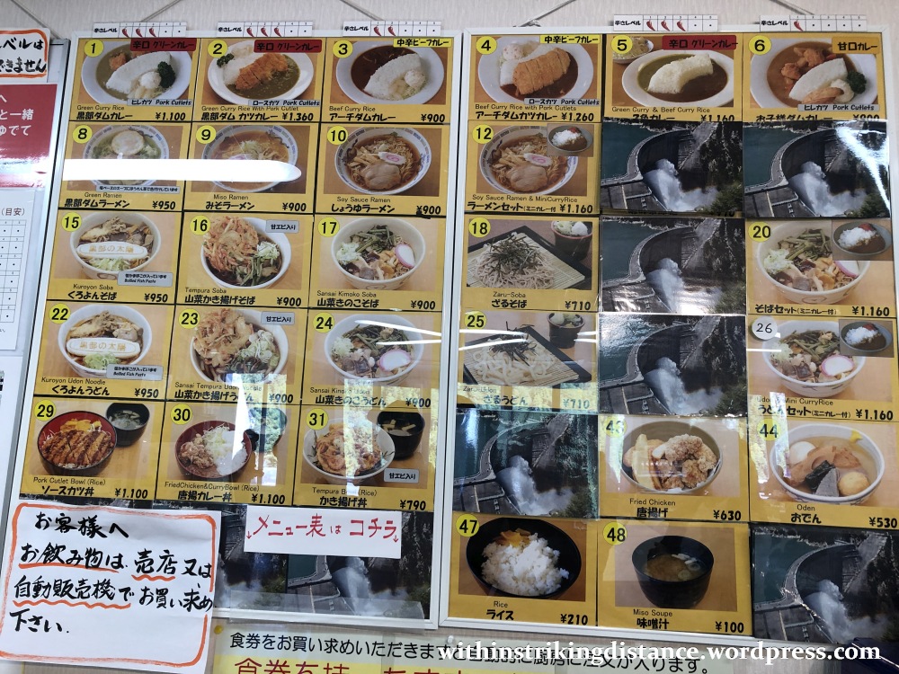
Orders are taken through a machine, which dispenses numbered meal tickets after one has tendered payment.
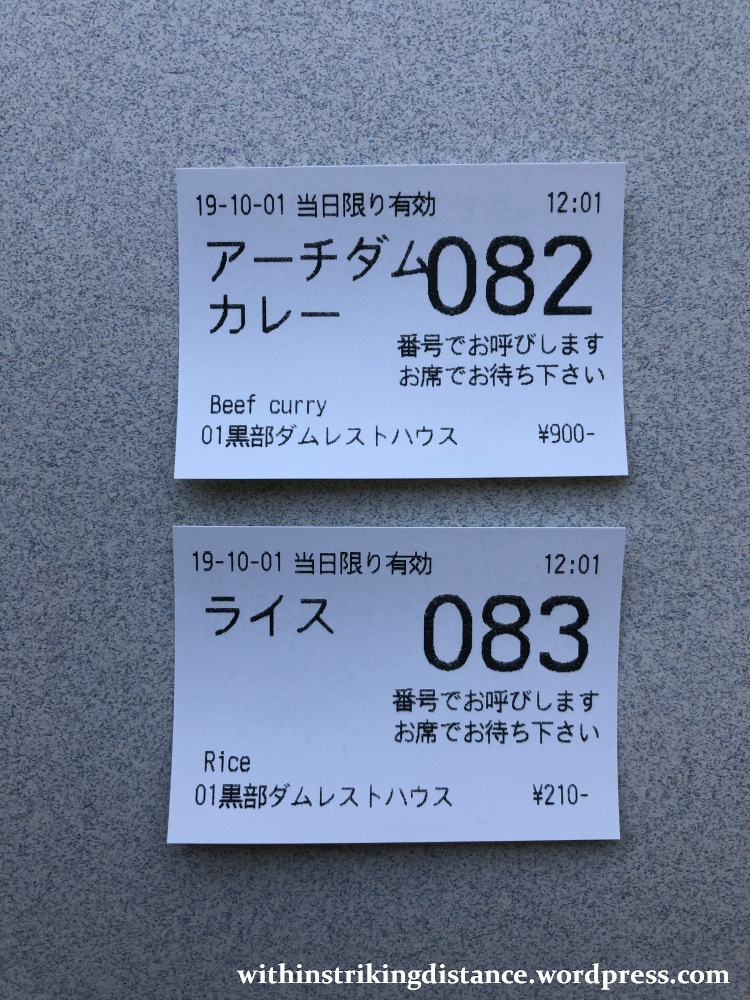
And here we are! My selections: a dish of “Arch Dam Curry” (900 yen) and a bowl of extra rice to enjoy with the curry sauce (210 yen). To wash everything down, I picked up a bottle of local cider (200 yen) from the refrigerator.
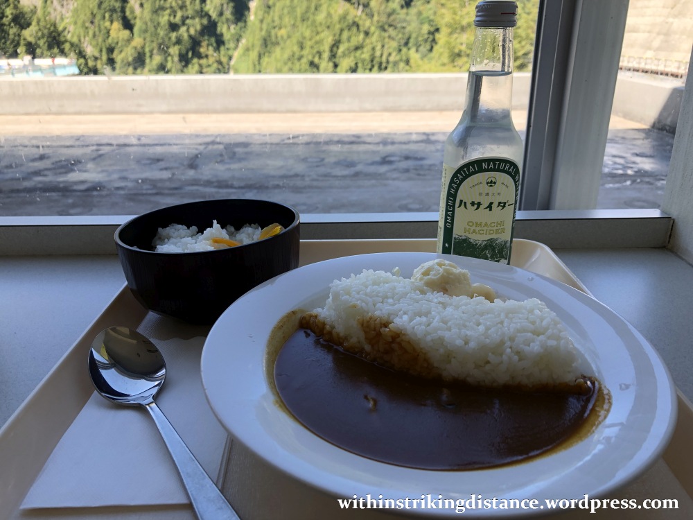

Mmm, just look at that scene. A dam of rice holding back a lake of rich beef curry, with a scoop of potato salad and a couple of pickled onions cowering in fear at the flavourful sauce that threatens to engulf them in a flood of deliciousness.
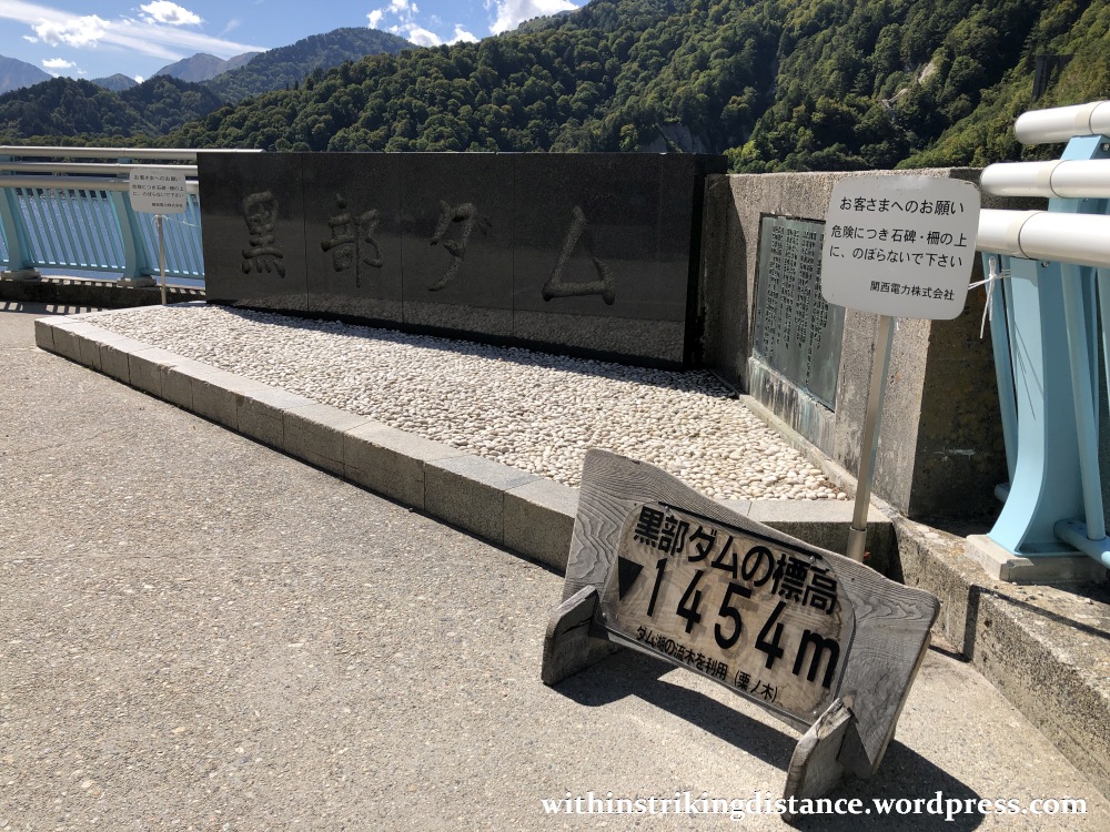
Having made short work of the meal, I did the obligatory stop at the dam’s signposted photo spot…
…followed by a stroll down the long tunnel leading to Kurobe Dam Station, where I would eventually catch an electric bus to the next stop on the Alpine Route. (More on that in my previous post.)


To sum everything up: a short but enjoyable stop on the Tateyama Kurobe Alpine Route.
In my next post, I’ll tell the tale of an earlier stop on the Alpine Route, this time featuring the great big outdoors and the seasonal beauty of autumn.
Till then, cheerio!

2 thoughts on “Field Report: Kurobe Dam, Toyama Prefecture, Japan (01 October 2019)”