

There are many places of interest along Japan’s Tateyama Kurobe Alpine Route (立山黒部アルペンルート), the scenic corridor through the Hida Mountains between Toyama and Nagano Prefectures. Amongst them is one of the country’s largest alpine wetlands: a place that sleeps under a thick blanket of snow for much of the year, but stirs gloriously to life during the summer and autumn.
Welcome to Midagahara.
Like many of this tectonically active country’s natural landmarks, Midagahara (弥陀ヶ原) was born out of an ancient volcanic eruption. The flat expanse upon which the marshland sits is a pyroclastic plateau, composed mainly of material ejected from the nearby Tateyama volcano.
Due to the altitude (1,930 metres) and its geographic location, Midagahara is buried under snow for a good chunk of the year. In the spring and autumn, the snow melts away to reveal an alpine marsh: one of sufficient ecological significance to be included on the Ramsar List. Autumn in particular lends this place a special beauty, due mainly to the splendid seasonal colours that spread across the landscape from the tail end of September and through much of October.
My original plan was to stop over at Midagahara during an end-to-end crossing of the Alpine Route on 1st October. Finding myself with spare sightseeing time on 29th September, I decided to tick the wetland off the list in advance and free up more time during the full journey. For information on how I reached Midagahara from the nearest major city (Toyama), have a look through my detailed transportation report.
After getting off at Midagahara’s small bus terminal (just a shed really but let’s stick with “terminal”)…
…I took a few moments to complete two important tasks before hitting the nature trail.
First: making a seat reservation for the return bus. (More details about why that’s necessary in my related transportation report.)
Second: a last-minute toilet break. Due to its highly protected status, there are no lavatories on any of the boardwalk trails that loop around Midagahara.
The bus terminal is also stocked with maps and other resources that might come in handy for planning one’s way around the area. Of course, it’s not easy to get lost around here so long as one stays on the boardwalks. There are two main courses: a shorter loop (marked in blue below) that takes about 40-60 minutes to complete, and a longer route (in pink) that requires twice that amount of time.
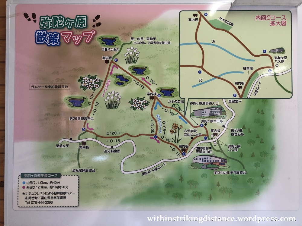
Here’s another map, with a little more English than on the one we saw earlier. This particular version was mounted on a wooden block near the start of the walking trails.

Incidentally, due to time constraints and lack of confidence in my endurance, I settled on the short course.
Right, that’s planning all sorted. Let’s head out!
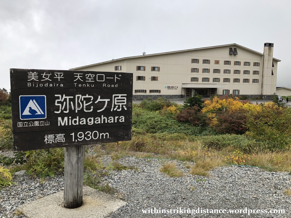
The building shown above is the Midagahara Hotel, one of a handful of accommodation options located along the Alpine Route. As I’ve written in my previous post, an overnight stay at one of these establishments is recommended if you’d like to do the full crossing at a more relaxed pace, with plenty of time for hikes and excursions. That said, where peak seasons such as autumn are concerned, one will likely find – as I did when planning my own holiday here – that rooms are in short supply or prohibitively expensive.
Enough chatter now. Let’s go for a stroll.


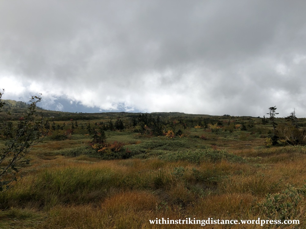
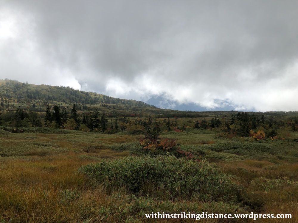
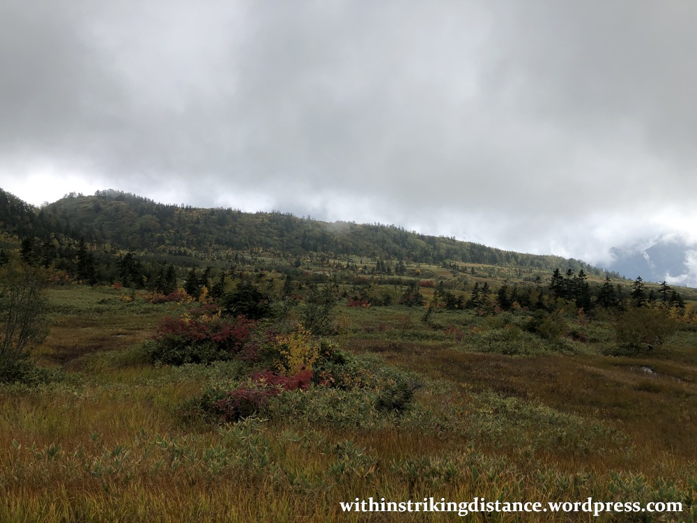
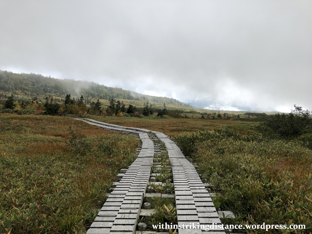
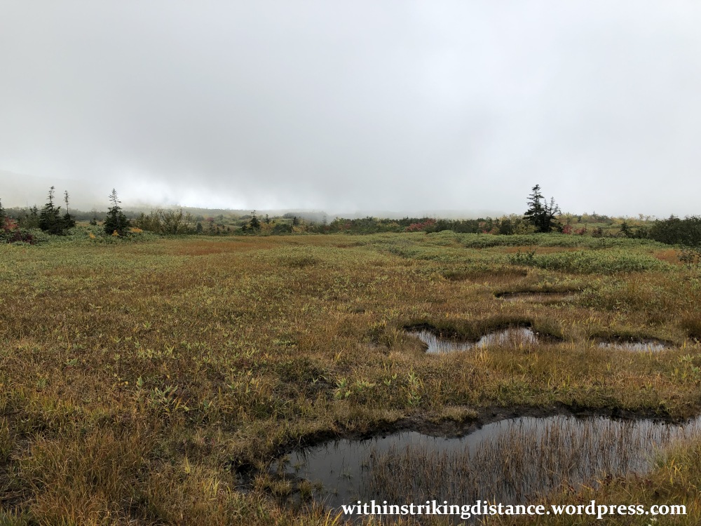
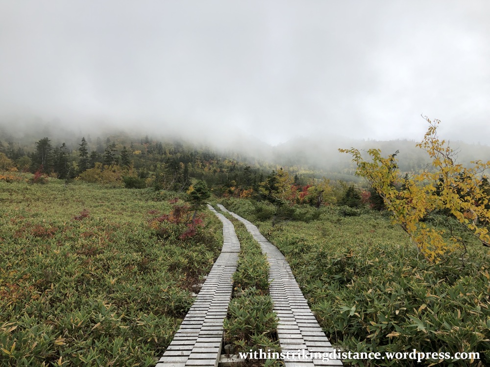

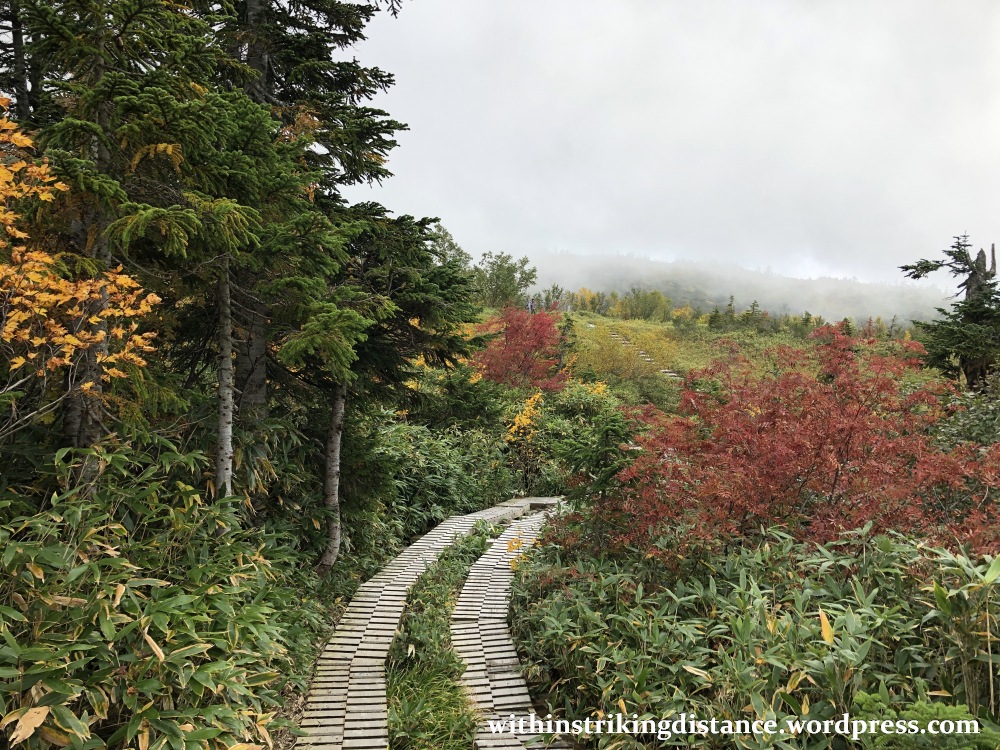

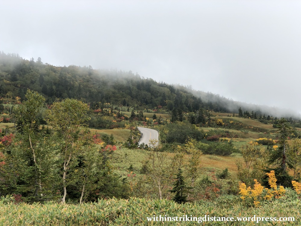

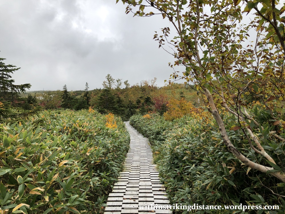

The views would have been much better during a clear day, with the surrounding mountains in plain sight – not obscured by rain clouds as was the case during my visit. That said, I found the walk very enjoyable indeed, with splashes of bright autumn hues spicing up the rolling green landscape.
Heavy though they were, the clouds overhead mostly withheld their threat of rain until after I’d reached the bus terminal. At that point, the taps were turned and Midagahara began to receive a rather heavy soaking. You can imagine how blessed I felt to have enjoyed the great outdoors before the deluge began!
Next came the long journey back to Toyama, as detailed in my transportation report.
And there we have it. I’d love to come back someday, hopefully in better weather and perhaps in an altogether different season (such as early spring before the snow melts).
Cheerio.

3 thoughts on “Field Report: An Autumn Stroll at Midagahara, Toyama Prefecture, Japan (29 September 2019)”