

Despite the size and grandeur of their royal capital Hanseong – modern-day Seoul – the kings of Joseon were only too happy to sprinkle secondary “capitals” across the realm for special or emergency use. The fortified city of Hwaseong in Suwon is probably the best-developed example, with a full circuit of walls and a sprawling palace at its centre. This spring, I explored another of Joseon’s backup “capitals”: a mountain fortress not far from Seoul that, during the Qing invasion of 1636-1637, really did serve (albeit for only a few weeks) as the monarch’s seat of power.
My starting point was Seoul, the capital of South Korea.
A beautiful day in early spring, with sunny skies and mercury readings in the single digits Celsius. Perfect conditions for an outdoor excursion.
Well, perhaps not-so-perfect if you’re sensitive to the cold, but I relish temperatures like these.
The target was about 18 kilometres away from my base in Seoul’s Dongdaemun area … measured as the crow flies, of course. But I am no crow, so straight-line measurements are of no use to me. (Nor are they of much use to actual crows, apparently.) Time and transport would serve us better for defining the journey ahead.
Now here’s something to bear in mind: Google Maps is rubbish in Korea because they lack full access to the country’s raw cartographic data. Depending on whom you ask, it’s to do either with security concerns over sensitive details (like the coordinates of army bases) OR with protecting domestic conglomerates keen on peddling their own navigation services. At any rate, if you’d like precise directions and timetables, put a homegrown map app on your mobile device before setting out. The dominant players in this league are Kakao Maps and Naver Map.
The most convenient route will depend on your starting point within the mind-boggling vastness of Seoul (amongst other things), but here’s one option. Ride the rails from wherever you’re based to Sanseong Station (Line 8)…
…and then transfer to bus 9 or 52. (Kakao Maps or Naver Map will lead you to the stop nearest the subway station.) The combined rail and bus trip – with a couple of walking transfers en route – took me about 75 minutes from Dongdaemun.
Today’s destination: the Joseon-era fortress city of Namhansanseong (남한산성).
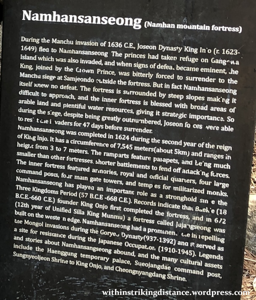
It’s not immediately clear from the satellite view above, but the small tourist town at the centre is surrounded by an extensive network of stone-clad walls. The natural defences of this rugged, elevated site in the midst of a thickly forested mountain were put to use as far back as the 7th century AD by the Kingdom of Silla, but the fortifications we see today were completed in 1624 during the reign of King Injo of Joseon (1595-1649, r. 1623-1649).
Designed and maintained as a secondary capital for national emergencies, Namhansanseong was tested by war not long after its construction. During the winter of 1636-37, Qing forces invaded the Kingdom of Joseon and overran the capital Hanseong (Seoul). The royal court of King Injo fled to Namhansanseong with thousands of troops, and there they withstood a Qing siege for several weeks before finally capitulating towards the end of January 1637. This event was recently depicted in the 2017 Korean film Namhansanseong (marketed internationally as The Fortress), where the walled city served as the primary backdrop.
For more historical context and other information, have a look at the related articles on Wikipedia and the UNESCO WHC (note: this place was designated a World Heritage Site in 2014). You’re also free to glance at this signboard I found next to the wall-top walking route – there might be a few nuggets of useful information somewhere in this field of worn-out letters, vague history and nationalistic propaganda.
From the large roundabout in the centre of town, I walked a short distance west towards the nearest information office – a small wooden building next to a grassy clearing. (It’s not in the picture below, but it’s just off-camera left of the gift shop with the thatched roof near the centre.)

I picked up a couple of maps and asked the staff if they could recommend a walking route. There’s a buffet of trails to choose from, of varying length and difficulty. Five are outlined in the map below, but these can be easily tweaked into numerous variations, and there are likely many other trails not shown (especially across the hilly terrain outside the walls).

Given my time constraints and preference for an easy stroll, the suggestion was a hybrid trail combining elements of Course 1 and Course 2 (n.b.: I’m using the numbers on the map above). This would allow me to cover a good chunk of Namhansanseong’s northwestern corner and enjoy one of its best viewpoints. I was advised to follow Course 1 north from the town centre to Bukmun (the northern gate), then west and south along the old ramparts as far as Seomun (the western gate) and Sueojangdae (the western command post). But instead of continuing south beyond that point, I’d cut the trail short by heading back east on the downward section of Course 2, ending my visit at Namhansanseong Haenggung (the royal palace near the centre of town).
Right, let’s head out.
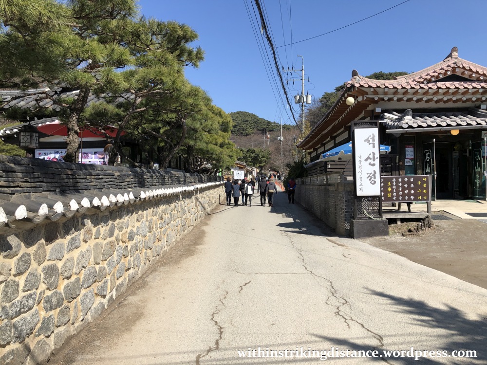
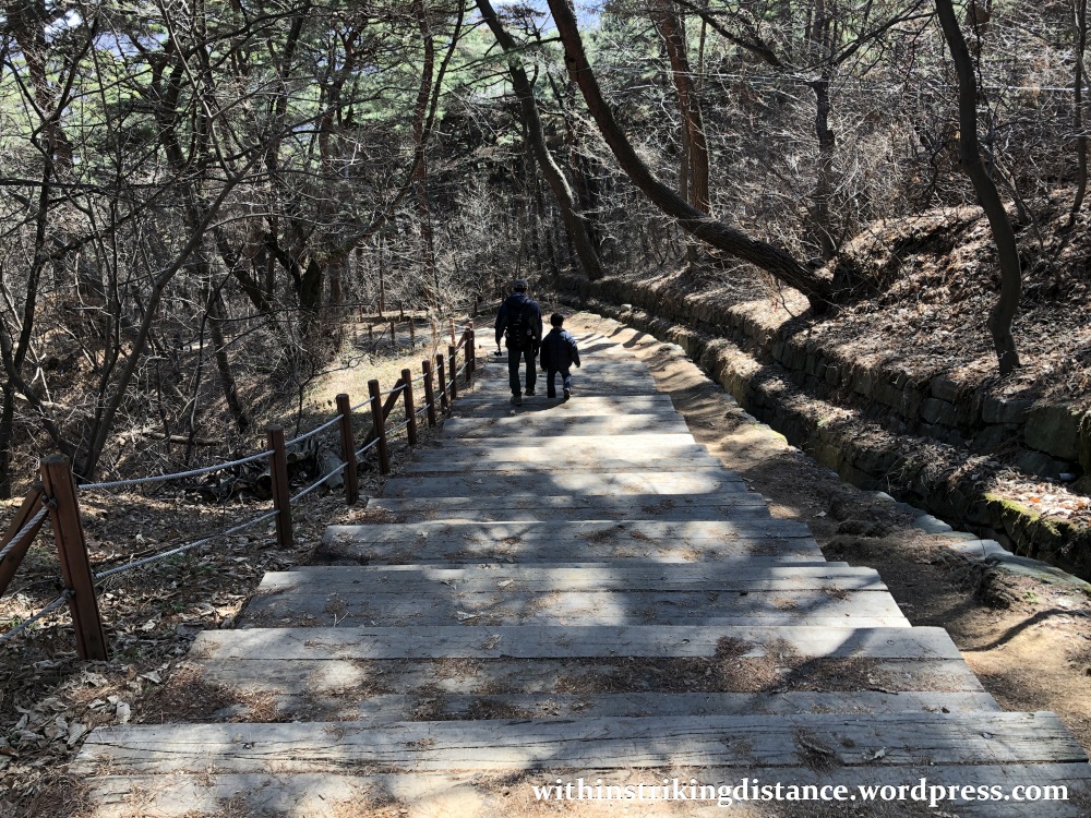
I set off on a gentle uphill slope, following a street lined with cafés and restaurants.
The barrier and signboard shown below mark the start of the protected area, which presumably encompasses the circuit wall of Namhansanseong and nearby buffer zones.


Before long, I encountered my first major landmark at the top of the slope: Bukmun, the main gate in the northern stretch of Namhansanseong’s fortress wall.

Sallying out of the gate for a brief look, I glimpsed the start of a hiking trail that led deep into the surrounding forest.
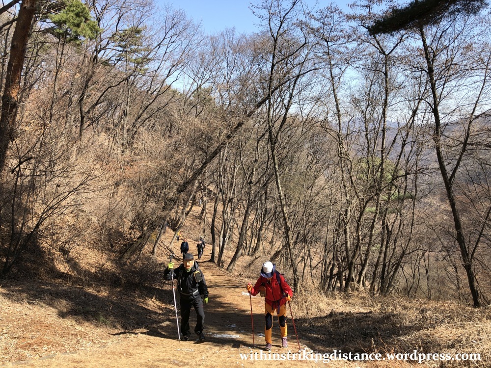
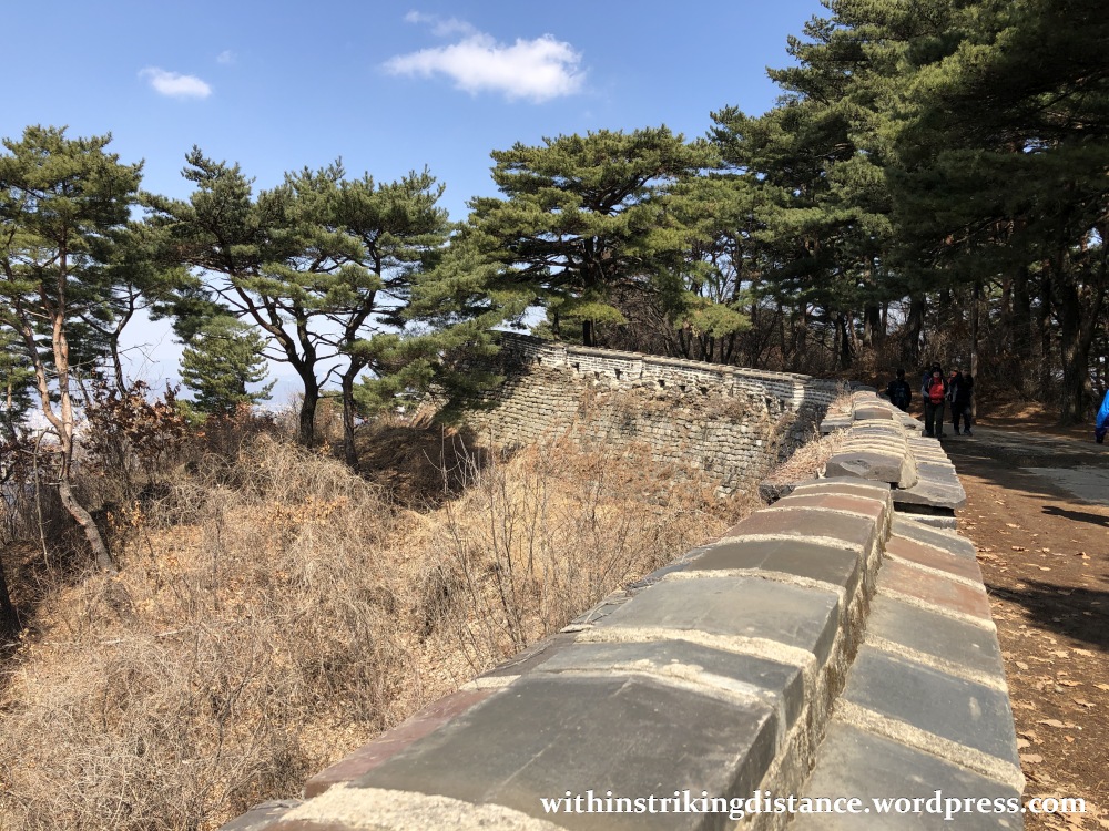
Darting back in through the gate, I continued west on a trail that mostly followed the old Joseon-era ramparts. It was mid-morning by then and visitor numbers were starting to swell.

From time to time, through breaks in the trees or above dips in the terrain, great views of the surrounding landscape would draw me to the edge of the wall.

About 700 metres northwest of Bukmun, I encountered a key decision point. The choice was between keeping straight on the left-hand path, which would ease me up onto the western ramparts by way of a moderate slope set some distance back from the wall…

…and turning right, hugging the wall as I moved northwest up an initial steep stretch that would eventually level off as it rounds the corner of the fortress boundaries.

Let me see. Just give me a moment to decide, weigh the pros and cons, calculate the expected risks and payoffs … whoops, too late, already shuffling along the easier route, haha.
The path ran close to the Gukcheongsa temple compound – close enough, in fact, for me to hear rhythmic chanting from within its precincts. I kept going past it on a determined slog to my next major landmark: Seomun, the main gate in the western wall.

I walked out of the gate and turned right, following a trail near the foot of the sloping stone wall. Shame about the metal scaffolding – but hey, I’m not one to stand in the way of essential restoration work.

Just a couple of minutes later, I arrived at a wooden platform built over the side of the mountain…
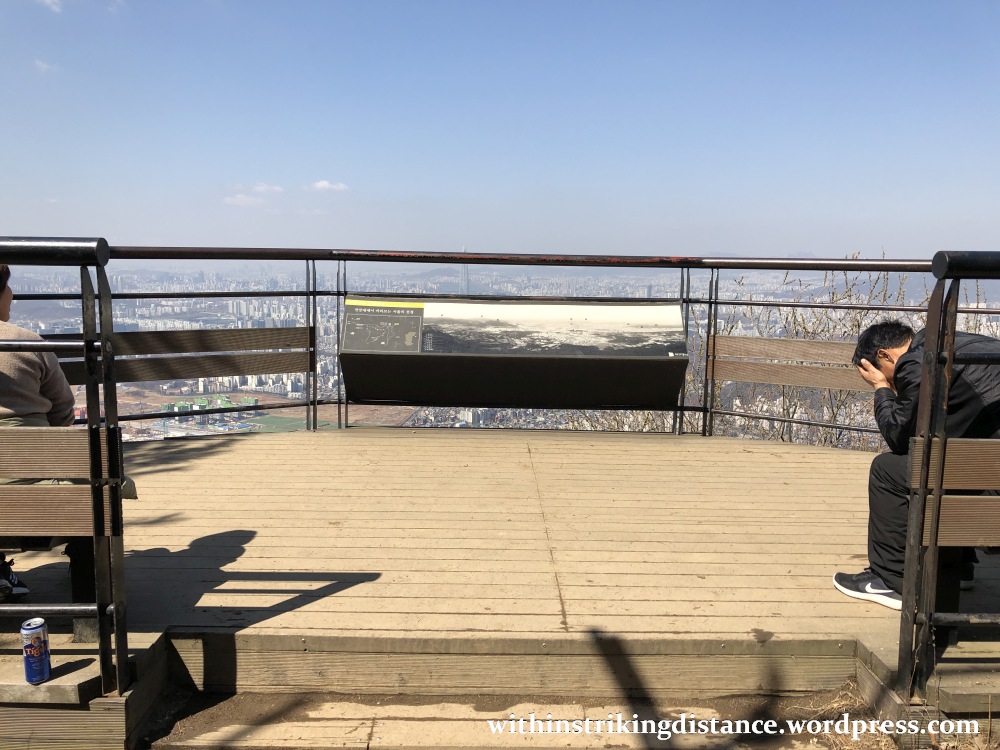
…from where I enjoyed a clear line of sight all the way to Seoul, miles to the northwest.
Ahh, what a view.
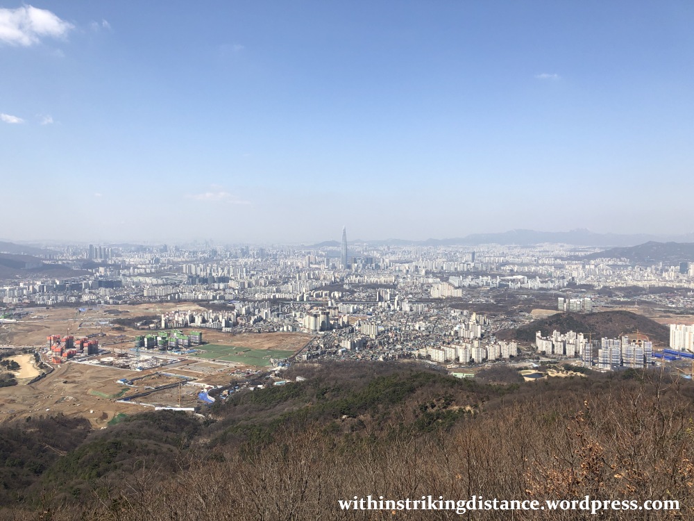

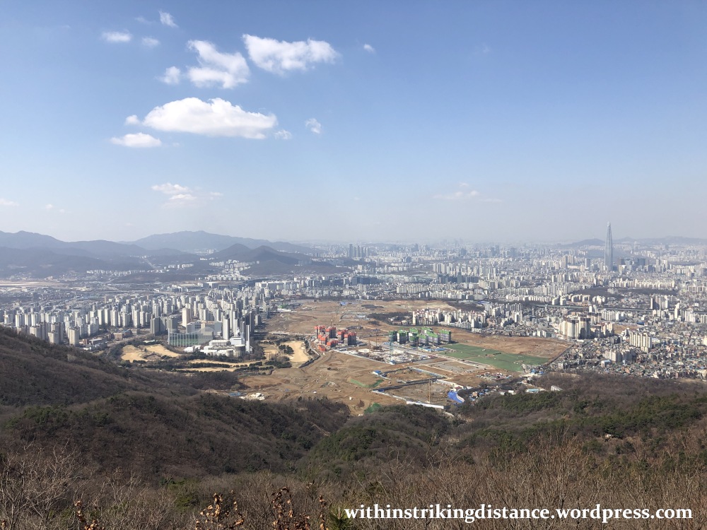
It’s not difficult to identify the most prominent landmark in this vista. At 555 metres in height, Seoul’s Lotte World Tower – the tallest building in Korea (for now) and one of the tallest in the world – practically dwarfs even the high-rise office and residential structures clustered nearby.
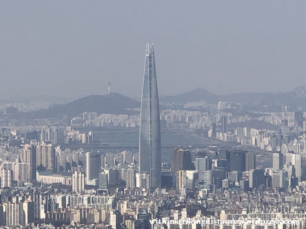
Here’s a close up of the skyscraper in question, with the fuzzy outline of N Seoul Tower poking out from the top of Namsan in the distance.
Back down to the gate now. Note the rather stark difference between the partly cleaned stretch of wall behind the scaffolding…
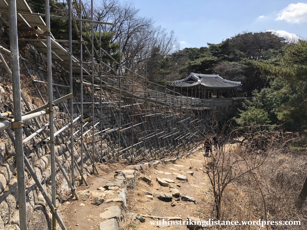
…and the plant-choked surface of the masonry just beyond Seomun, as yet untouched by maintenance work.

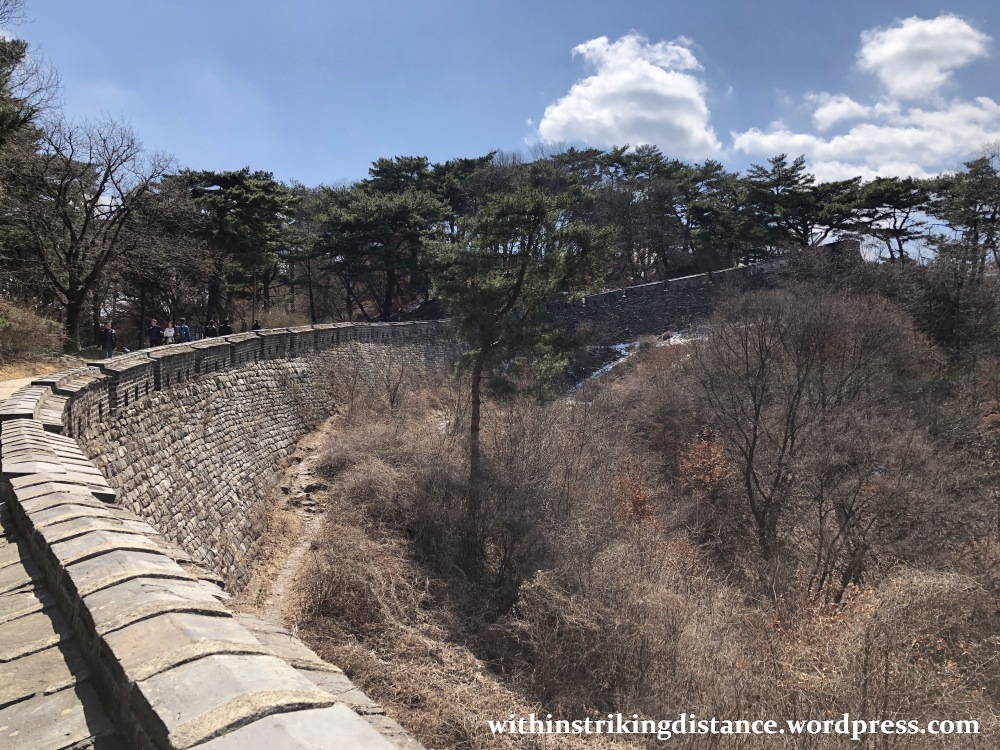
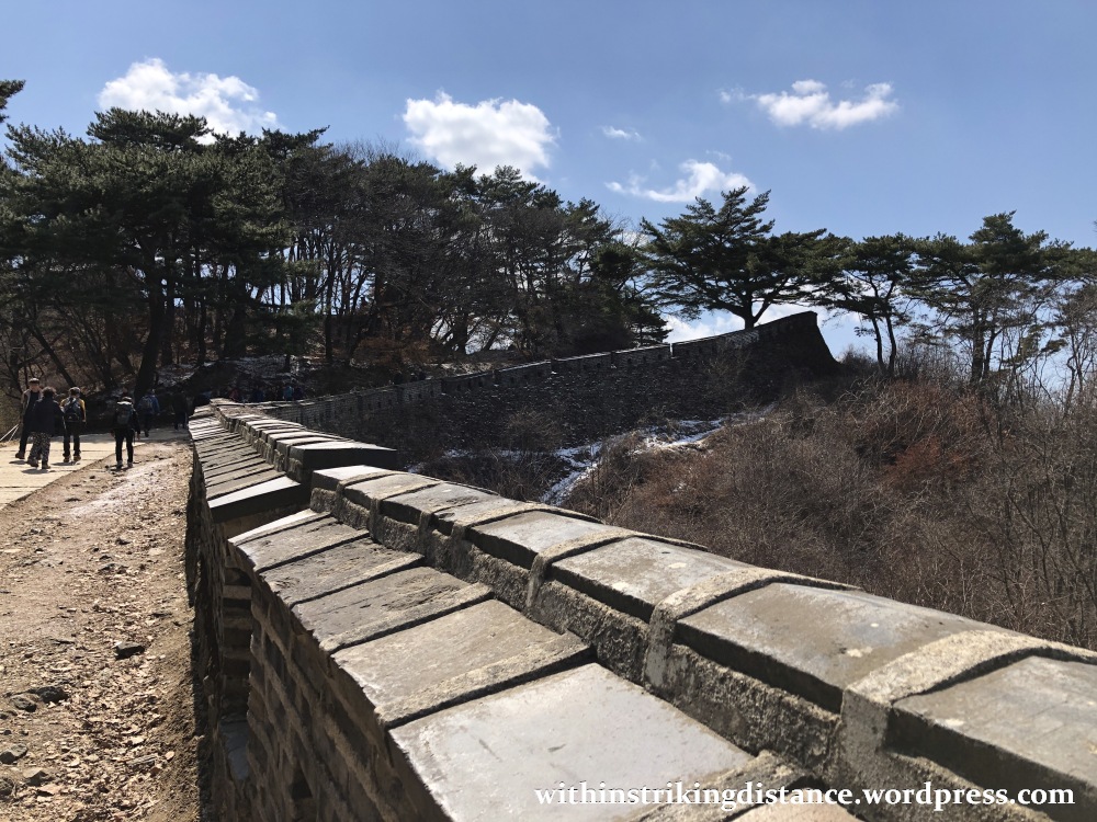
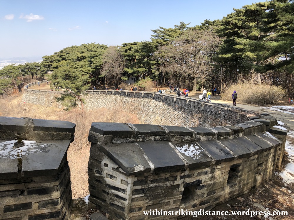
Back on the wall-top course, the crowds were visibly thicker than when I started that morning. No matter – there was plenty of walking space for everyone.

The area south of Seomun featured some particularly photogenic stretches of wall, with long curves and loops offering a variety of vantage points.


Near the midpoint of Namhansanseong’s western flank, I veered away from the ramparts and turned left up a stretch of road paved with rough stones…
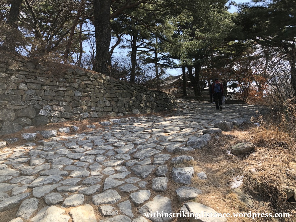
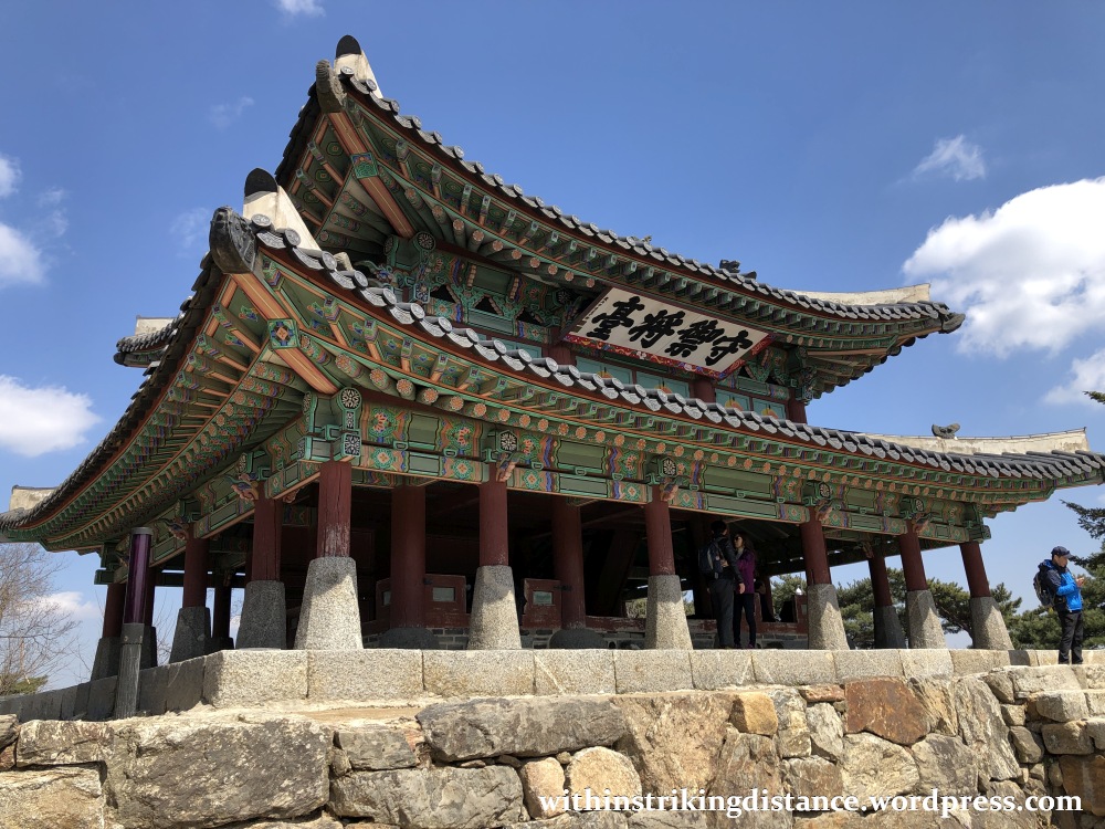
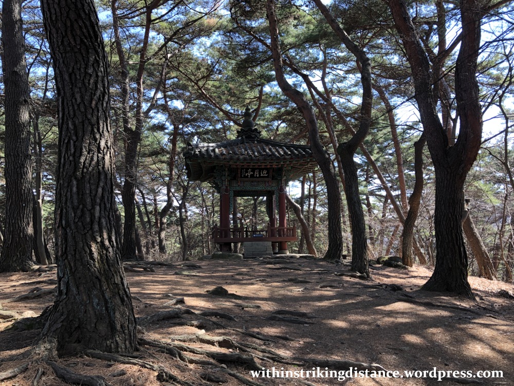
…which led to Sueojangdae, the western command post of Namhansanseong. There were originally five jangdae – elevated structures from where generals would command their troops – along the fortress walls, but only Sueojangdae now remains.

Off to one side of the compound is a small shrine. This precinct was erected to the memory of a Joseon-era official who had been unjustly put to death on trumped-up charges.


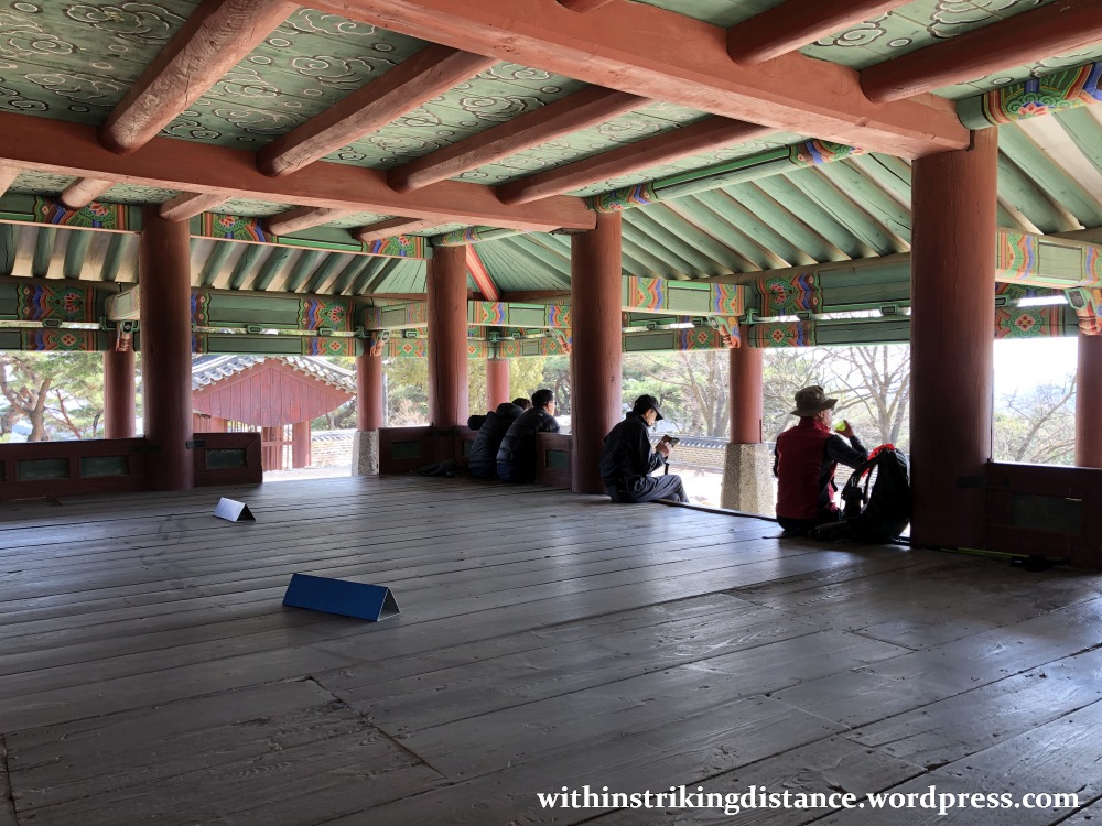
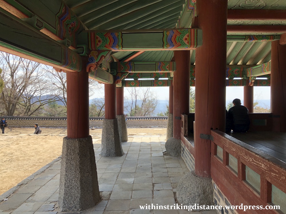
The wooden two-storey main structure of Sueojangdae sits on a raised stone platform. Given one’s normal expectations of rugged, sterile architecture in a martial context, this elaborately decorated building seems more like a royal pavilion than a general’s HQ.


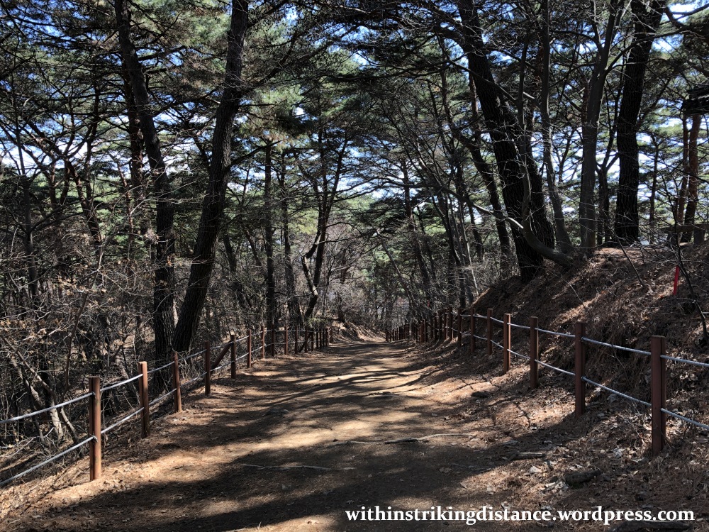
From here, I walked north on top of the wall for a short distance – maybe a hundred metres or so – and turned east on a downhill path leading back to the centre of town. Despite the lack of key landmarks or viewpoints along the route, I found this quiet stroll through the forest remarkably enjoyable. So peaceful was the setting that at times, I felt as if I were the only person on earth.

On my descent, through a break in the trees, I caught sight of one of Namhansanseong’s most important landmarks…

…but let’s save that for another post.
Till then, cheerio.

One thought on “Field Report: The Northwestern Walls of Namhansanseong Fortress, Gyeonggi-do, South Korea (24 March 2019)”